These maps show how much snow Southern New England could receive from first storm of season
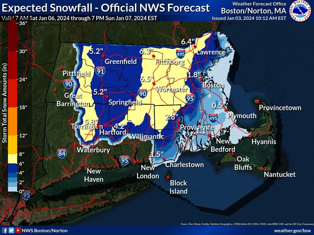
This map shows how much snow is expected to fall in Southern New England.
Seasonably cold air will overtake the Northeast later this week, setting us up for what could be our first significant snowfall of the season.
With cold air in place, much of Southern New England will see “mostly a snow event Sunday,” said Globe meteorologist Dave Epstein.
Weather models are forecasting the snow to begin falling late Saturday night and into a good part of Sunday across Southern New England, according to the National Weather Service in Norton. The Greater Boston area will turn blustery and much colder Thursday night into Saturday before a strong low brings potential “plowable” snow later in the evening Saturday.
The NWS says there is “lots of uncertainty” with the storm’s track and the amount of snowfall we will see, but it looks like the region may finally see some wintry precipitation after weeks of mild weather.
“There is still considerable uncertainty on snow amounts, including the location of the rain/snow line,” NWS meteorologists said Wednesday morning.
By Thursday afternoon and Friday, meteorologists should have more clarity on the amount of snow accumulation.
European ensemble models, as seen in the map below, show a middle range of snow potential.
Here’s a look at how much snow is expected to fall in each state as of Wednesday:
Massachusetts, Rhode Island and Connecticut
Rhode Island
Vermont
New Hampshire
Maine