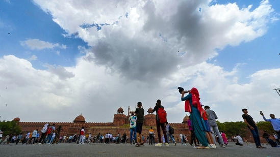
Cloud cover traps surface heat after blazing days, leads to sultry nights
Forecast for Saturday shows Delhi is likely to record heatwave conditions yet again.
While days have been unbearably hot in Delhi for nearly a month now, the respite that city residents usually enjoyed at night was also taken away on Friday as the minimum temperature soared to 33.3 degrees Celsius – the highest it has been in the month of June in six years.
With a minimum temperature of 33.3°C – five degrees above normal – Delhi recorded what weather scientists refer to as a “warm night”, when the day’s maximum is over 40°C and the night-time or minimum temperature is more than 4.5 degrees or more above normal. To be sure, this minimum reading was taken early on Friday, which means the heat was more in the morning.
The maximum on Friday, meanwhile, was at 44°C – 4.1 degrees above normal. This means that throughout the day, Delhi residents experienced temperatures in a narrow band of 10.7°C. For context, a day earlier this range was 15.4°C with a maximum of 44.8°C and a minimum of 29.4°C.
Lower the gap between the day’s maximum and minimum, the more heat is felt on the human body as there next to no relief from heat stress, even during the night.
The last time Delhi had a higher minimum temperature in June was in 2018 when the reading soared to 34°C on June 13, according to India Meteorological Department (IMD) data.
The rise in minimum temperature was caused by combination weather factors that played into each other on Thursday, scientists said. In the day, dry westerly winds and clear skies led to a rise temperature, which caused the ground to heat up severely. But by night, a moderate cloud cover took over Delhi due to an approaching western disturbance which meant this heat could not be transmitted back into the atmosphere due to the greenhouse effect.
“Normally during this spell, we have seen clear sky conditions both during the day and night. The heat accumulated during the day is later lost into the atmosphere and the minimum comes down to around 29°C at night. On Thursday night and in the early hours of Friday, the cloud cover did not allow the heat to be lost,” said an IMD official, stating “warm nights” are not uncommon during a heatwave spell.
This same cloud cover also caused isolated instances of drizzle in parts of Delhi on Friday.
While the difference between maximum and minimum was just 10.7°C at Safdarjung, it was even lower at Pitampura (10.2°C), where a high of 45.9°C was recorded during the day, but the minimum was 35.7°C, considerably above normal.
Prior to Friday, the highest minimum this season was 31°C, which was recorded on June 5.
Mahesh Palawat, vice president at private weather body Skymet said the clouds on Thursday and Friday created a greenhouse effect, not allowing the heat to escape effectively.
“We have seen two factors impacting Delhi’s nights this season. One, we have seen strong westerly winds blowing even at night time. These dry winds provide a sustained effect of heat, even at night. Secondly, spells of cloudiness, none more prominent than on Thursday night, created a lid and did not allow heat to escape,” said Palawat.
IMD data from May 15 onwards – when heatwaves began to impact large parts of northwest India, shows Delhi’s minimum temperature has been normal or below normal on only seven days. In the remaining 24 days, it has been above normal.
IMD data till 5.30pm on Friday showed “trace” rainfall was recorded at the Ayanagar weather station, while 1mm rain was recorded in Noida. Isolated stations such as Pitampura (45.9), Jafarpur (45.8) and Pusa (45.6) recorded heatwave conditions, making it the sixth consecutive day where at least one station in Delhi recorded a heatwave.
Forecast for Saturday shows Delhi is likely to record heatwave conditions yet again. Delhi is also likely to record gusty winds of up to 40-50 km/hour during the day, with chances of a drizzle in some parts of Delhi. The maximum and minimum is likely to be 44 and 31°C, respectively.
Read more news like this on HindustanTimes.com