Tropical Storm Beryl expected to form soon in the Atlantic
Tropical Storm Beryl expected to form soon in the Atlantic
A quickly-organizing tropical wave is expected to intensify late Friday or early Saturday into Tropical Storm Beryl, and will probably bring strong winds, rough surf and heavy rains to the Lesser Antilles, a group of islands in the Caribbean Sea, by early next week. Tropical storm watches and warnings will probably be hoisted over the weekend, and there’s even a growing chance the storm could become a hurricane in the Caribbean in the coming days.
Weather models are aggressive on prospects for the system to develop. It’s about 1,500 miles south-southeast of the Windward Islands, and is drifting west at about 15 to 20 mph. Conditions favor steady strengthening of the system, and rapid intensification can’t even be ruled out. Those around the Caribbean should keep close tabs on the storm’s progress through the middle of next week.
Meanwhile, there are also two other disturbances in the Atlantic, each with 30 percent odds of eventual development. One is a robust tropical wave rolling off the coast of Africa, and the other is in the western Caribbean and is soon to soak the Yucatán Peninsula with heavy rains.
It’s only June, but the Atlantic is exhibiting mature development over the Main Development Region, or the imaginary box of oceanic real estate between South America and Africa in the tropical Atlantic. That’s more typical of late July or August. Experts are calling for this hurricane season to be particularly busy or even hyperactive, owing to anomalously warm sea-surface temperatures and supportive upper-level winds tied to a burgeoning La Niña pattern.
What to know about soon-to-be-Beryl
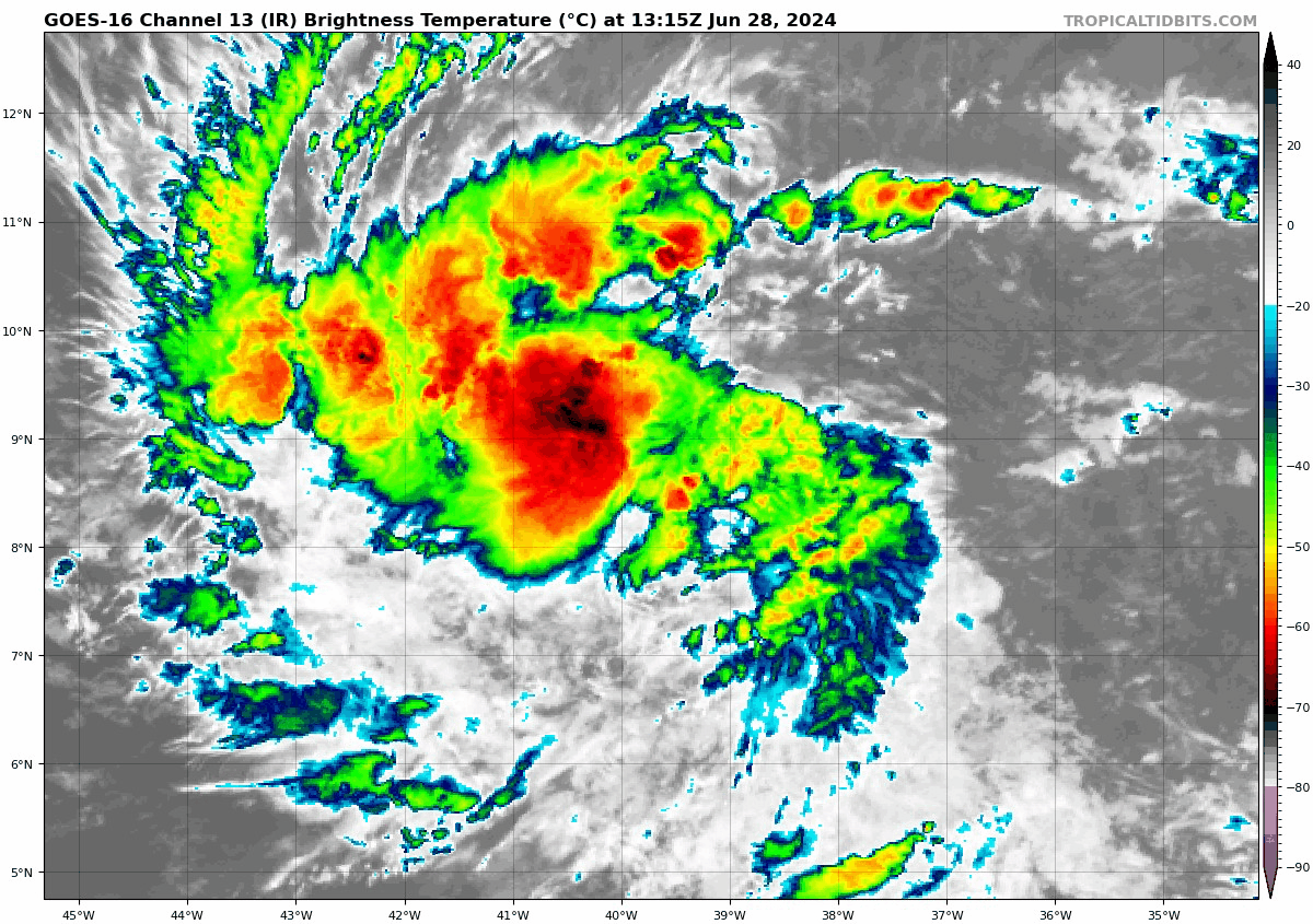
An infrared satellite view of the disturbance over the central tropical Atlantic. (Tropical Tidbits)
The system now
Tropical storm or hurricane watches could be needed as early as Friday night for portions of the Windward Islands and Lesser Antilles. Invest 95L, the current designation that the National Hurricane Center is using for the storm that will become Beryl, has a “near 100 percent chance” of developing.
In fact, it might even already be a tropical storm, but meteorologists need confirmation of a closed low-level circulation, or area of spin, with winds at or above 39 mph. That would probably require data from a scatterometer — or an instrument mounted to a satellite that can ascertain a system’s wind field. Such a satellite hasn’t passed overhead recently.
It’s more likely that, until then, the National Hurricane Center will declare the system a “tropical depression” — a step below a named storm.
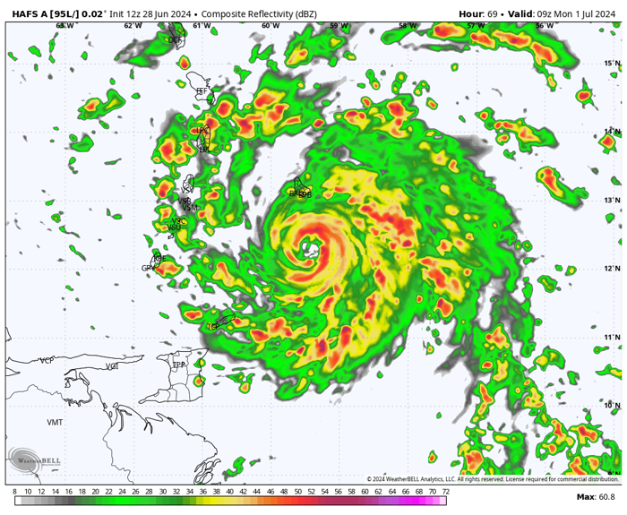
Regardless, the system looks very healthy. It’s roiling with deep convection, or shower and thunderstorm activity.
A satellite image showing soon-to-be-Beryl over the open Atlantic. (Tropical Tidbits)
It also has a clear spin on satellite. And notice the “outflow,” or high-altitude exhaust exiting the storm at the top. That’s evident in the thin, wispy cirrus clouds fanning out from the center. That shows the storm is breathing — inhaling warm, moist air from below and evacuating “spent” air from above. That’s a sign of a well-organized disturbance.
What’s next
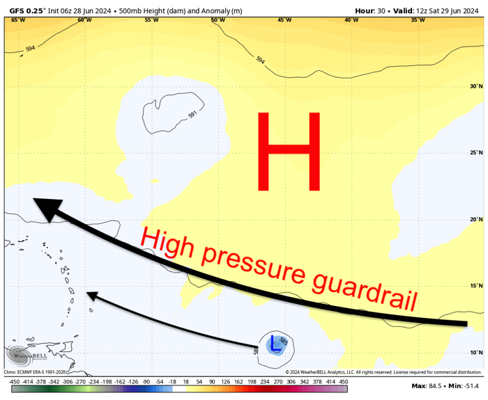
Tropical Storm Beryl will stay south of a sprawling ridge of high pressure currently parked over the open Atlantic. (WeatherBell)
A dome of high pressure over the central Atlantic will act as a force field of sorts, suppressing the system south and preventing it from “recurving,” or escaping to the north. Since highs spin clockwise, the incipient storm will continue almost due west. That will take it toward the Lesser Antilles by Monday.
Its southerly path means it will escape the majority of hostile high-altitude winds to the north. Strong upper-level winds can tear apart a fledgling system. This won’t be an issue.
The storm will also stay south of the SAL, or Saharan Air Layer — a lid of hot, dry desert air and dust about a mile or two above the ground. That dry air can erode a developing storm’s, but that won’t be an obstacle here.
Through Monday, the storm will strengthen, perhaps into a hurricane, as it extracts energy from the warm waters of the tropical Atlantic. Then, after breezing through the Lesser Antilles, where wind, rain and surge are possible, it will enter the Caribbean. Conditions look even more ripe for strengthening there.
Other systems to watch
There are two other disturbances worth keeping an eye on in the Atlantic. One in the northwestern Caribbean is organizing some, but may lose that organization as it moves inland over the Yucatán Peninsula over the next 48 hours. Thereafter, it may try to regain some strength in the Bay of Campeche into early next week. Heavy rains and flooding are possible, with 4 to 8 inches of rain in extreme northern Belize and Guatemala and the Yucatán.
Otherwise, another tropical wave over Africa appears poised to develop during its long trek across the Atlantic.
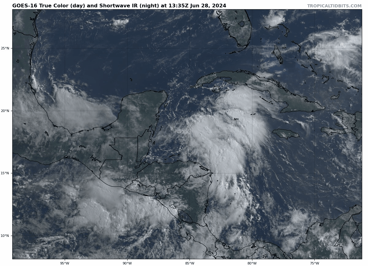
A disturbance in the western Caribbean that could bring very heavy rain to the Yucatán. (Tropical Tidbits)