Weekend rain bomb about to strike Australia along with polar blast
- Australia set for another cold weekend
- Strong winds and showers also forecast
- READ MORE: Heartbreaking reason mum gave beggar $20
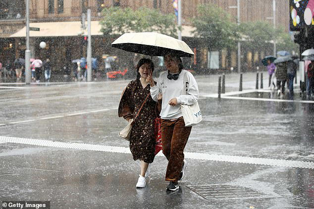
Australians living in the largest capital cities have been warned to rug up once again with more cold, wet and windy on the way.
South-east Australia is about to get hit by super-chilled air from the Antarctic which will cause thermometers to plunge.
As the cold air hits a north-west band of cloud, it is set bring rain to widespread areas.
Sky News Weather Meteorologist Rob Sharpe said the cold front would work its way across the south east of the country.
'Melbourne is looking windy and then wet,' he said on Friday.
The night-time temperature for Melbourne is set to plunge in particular on Sunday and Monday night with the Bureau of Meteorology predicting it will fall to 6C with northerly winds of 35 to 50 km/h.
Canberra is set to see overnight temperatures below zero and a frost is predicted for Monday morning.
Then it will be NSW's turn to shiver, after enjoying a warm 20C on Saturday followed swiftly by a three to four degree drop.
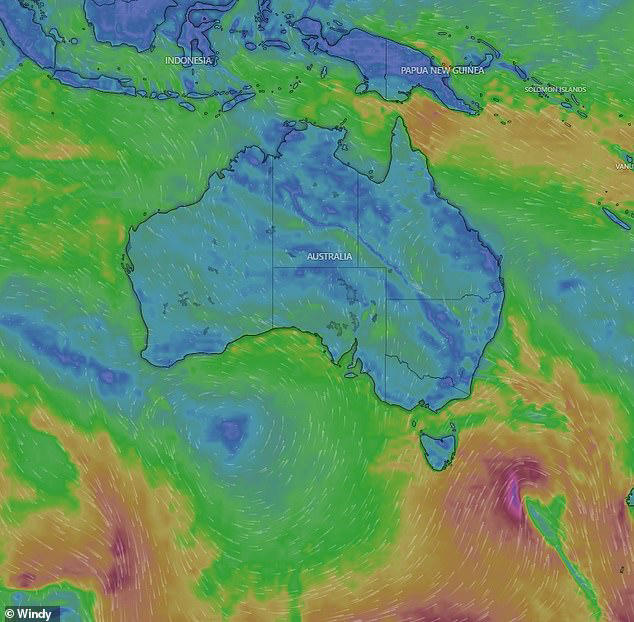
A front of Antarctic cold is set to make those in south east of Australia shiver over the weekend
Light south to south-westerly winds are expected during the day which will become even lighter during the evening.
'The cold behind that rain band will then run across NSW,' Mr Sharpe said.
'For Sydney, more wet weather for Sunday.'
However, the cold snap is good news for skiers.
'Colder weather is brewing. Probably, for most of the ski-fields, there will 20cm of snow which will be pretty handy there,' Mr Sharpe said.
Strong winds are also likely across the resorts and surrounding areas for Saturday and Sunday.
Rain is expected to reach 40 to 80mm in eastern and central Queensland including the northern Goldfields, Coalfields and Highlands but Brisbane and the surrounding region will likely only receive 5 to 10mm.
Along with the cold and sometimes windy conditions showers are also expected for large parts of Australia over the weekend
The Capricornia coast, Whitsundays and coast through the middle of the state could expect a few showers.
Adelaide will also feel the cold front's impact, with minimums falling to 6C over the weekend and around 10 to 20mm of rain expected.
Meanwhile Perth has been enjoying warmer weather than usual for this time of year but it will see lows falling below 10C, but daytimes temperatures hovering around the 20C mark.
THREE-DAY WEATHER FORECAST IN YOUR CITY
SYDNEY
Saturday: Min 7C, Max 20C, cloudy
Sunday: Min 12C, Max 17C, possible showers
Monday: Min 8C, Max 16C, showers
MELBOURNE
Saturday: Min 10C, Max 12C, rain
Sunday: Min 6C, Max 12C, possible shower
Monday: Min 6C, Max 12C, showers
ADELAIDE
Saturday: Min 10C, Max 15C, showers
Sunday: Min 6C, Max 14C, cloudy
Monday: Min 5C, Max 14C, cloudy
PERTH
Saturday: Min 10C, Max 19C, cloudy
Sunday: Min 8C, Max 19C, sunny
Monday: Min 7C, Max 19C, sunny
HOBART
Saturday: Min 9C, Max 14C, possible shower
Sunday: Min 6C, Max 10C, showers
Monday: Min 4C, Max 11C, cloudy
CANBERRA
Saturday: Min -1C, Max 13C, possible shower
Sunday: Min 3C, Max 11C, showers
Monday: Min -2C, Max 11C, frost
BRISBANE
Saturday: Min 14C, Max 24C, cloudy
Sunday: Min 16C, Max 26C, cloudy
Monday: Min 17C, Max 24C, showers
DARWIN
Saturday: Min 23C, Max 33C, cloudy
Sunday: Min 23C, Max 33C, sunny
Monday: Min 22C, Max 32C, sunny
Read more