Strong Earthquake Triggers Tsunami Warning
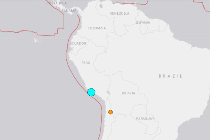
Screenshot from USGS showing the location of the 7.2 magnitude earthquake that struck Peru on the morning of June 28. The blue circle is the earthquake and the red lines show tectonic plates.
A powerful earthquake struck near the coast of Peru early Friday, triggering a tsunami warning for the region and injuring at least five people, according to the country's health ministry.
The 7.2 magnitude quake hit just outside Peru's second most populated city, Arequipa, at approximately 12:36 a.m. local time, the strongest in that part of Peru in over 23 years, according to a report from Volcano Discovery. The event prompted the country's National Tsunami Warning Center to issue an alert, indicating a "possible" tsunami, and its U.S. counterpart estimated that waves could reach between one and three meters above tide level along certain parts of Peru's coast. An update from the Peruvian navy's Directorate of Hydrography and Navigation suggested the threat had passed.
"So far no tsunami wave has been reported, likely because this earthquake was too small and did not offset the seafloor by a significant amount," Sam Wimpenny, an expert in geology and tectonics at the University of Bristol in the U.K., told Newsweek.
The Peruvian government said on X, formerly Twitter, that it was monitoring the situation and determining "the actions to be taken."
Newsweek has reached out to a representative of the Peruvian government via email for comment.
Two smaller aftershocks between 4.4 and 4.9 magnitude were recorded by the United States Geological Survey.
There were reports from local officials of damage to houses and buildings, but no fatalities, according to Reuters.
The seismic activity also disrupted power and telecommunications in areas near the epicenter, Reuters reported. "There have been power and telephone outages in several locations close to the quake's center," said Ricardo Guillen, a representative of the National Emergency Operations Center.
Peru's Ministry of Transport and Communications said it had activated emergency protocols and was "monitoring the state of roads, ports, airports and communication services in the area."
Wimpenny explained that landslides are common secondary risks of earthquakes and often these pose a higher risk to the public than the earthquake itself.
The USGS said that estimated economic losses from the quake were less than one percent of Peru's $268 billion GDP.
Peru's national police service issued earthquake safety advice to citizens on X, including what to put in an emergency backpack and to be familiar with evacuation routes. Wimpenny said the population had a relatively small exposure to the earthquake.
Earthquakes are common in Peru, as the country is located in the seismically active region known as the Pacific Ring of Fire.
This area, where tectonic plates meet, experiences frequent seismic activity, including earthquakes and volcanic eruptions. Wimpenny, the Bristol-based geology and tectonics expert, told Newsweek that: "Along the plate boundary between South America and the Pacific a magnitude 7 earthquake occurs roughly every year, so this event is not unusual. There is not significant change in earthquake rates recently for earthquakes of magnitude 7 that we can detect."
On average, Peru experiences around 513 earthquakes annually, according to EarthquakeList.
Update, 6/28/24, 7:36 a.m. ET: This article was updated with additional comment.
Do you have a story we should be covering? Have you ever experienced an earthquake? Contact [email protected]
Start your unlimited Newsweek trial