‘Rapid’: States bracing for icy blast
Freezing cold air from south of the continent has plunged temperatures below freezing for parts of the wider southeast corner.
The Bureau of Meteorology has issued frost warnings effective Monday morning for stretches of South Australia and Victoria.
A bureau spokesperson said a low pressure system in the Tasman Sea was steering a cold southerly wind towards south-east Australia, bringing chilly air from the southern ocean northwards.
“This is causing daytime and night time temperatures to be below average for much of Tasmania, Victoria, NSW, ACT and southern Queensland,” the spokesperson said.
‘Rapid’: States bracing for icy blast
“Cloud coverage cleared across much of the southeast over the weekend. Due to these clear skies, the temperature overnight cooled rapidly, leading to a chilly, and even frosty start for some places today.
“While the afternoon maximum temperatures may rise a few degrees, the cool nights are here to stay all week, possibly even colder for many areas on Tuesday morning and again on Wednesday morning,” the spokesperson said.
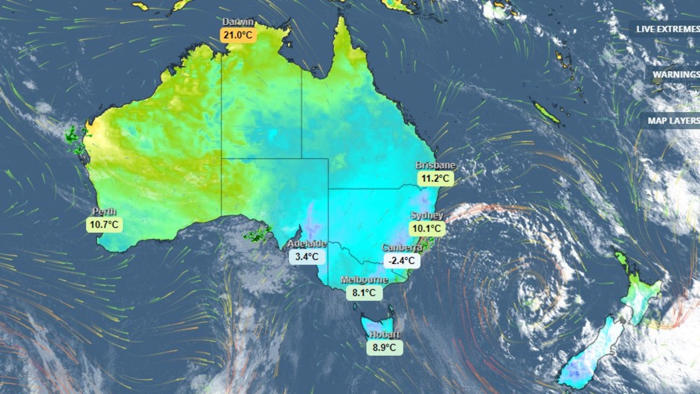
Frosts with temperatures down to -1C were forecast for Monday morning in parts of the Mallee, Wimmera and North East in Victoria, while parts of the Mid North, Riverland, Murraylands, Upper South East and Lower South East in SA were set to feel the frigidity.
“Temperatures at ground level can be many degrees lower than those recorded by standard weather stations, especially in calm conditions with clear skies,” the bureau warns.
Mildura got down to 0.8°C Monday morning. Nuriootpa, 70 kilometres outside of Adelaide, got to -0.6C at 3am. Mudgee in the NSW Central Tablelands tipped -0.7C about 6.30am.
Weather stations in the Alps dipped below freezing, and winds sunk the ‘feels like’ temperature even further, hitting -10.5C at Falls Creek.
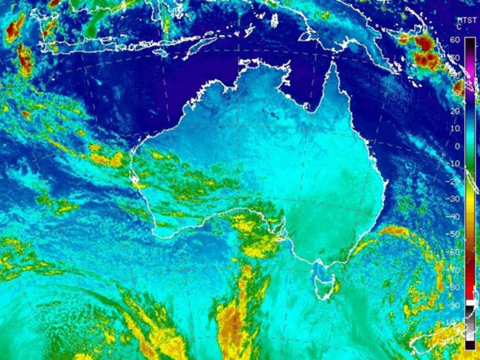
Satellite imaging from the bureau shows bands of freezing air lingering off in the Southern Ocean.
A large slow-moving low system over the Tasman Sea is kicking up winds along the east coast as well.
“A Tasman low is generating a significant area of strong to gale force winds across the Tasman Sea creating a large southwest swell,” the bureau warns.
“Damaging surf conditions, with waves exceeding five metres in the surf zone, may produce significant beach erosion,” the bureau warns for Lord Howe Island.