Showers, thunderstorm risk rain on southern Ontario's weekend parade
After a fairly soggy April, many southern Ontarians may now be looking forward to a month of blooming flowers and warmer temperatures. And for the first couple of days, at least, that’s what folks got.
Unfortunately, the sunny days don’t last forever; a reality those in the Chatham and Port Stanley areas were reminded of as rumbles of thunder rolled through early Friday morning.
This thundery system will continue to travel through southern Ontario on Friday, with a series of low pressure systems making their way to the Great Lakes regions over the weekend and extending into next week. These systems will bring rounds of rain and thunderstorm risks to the region.
SEE ALSO: May is here, along with all its Canadian weather extremes
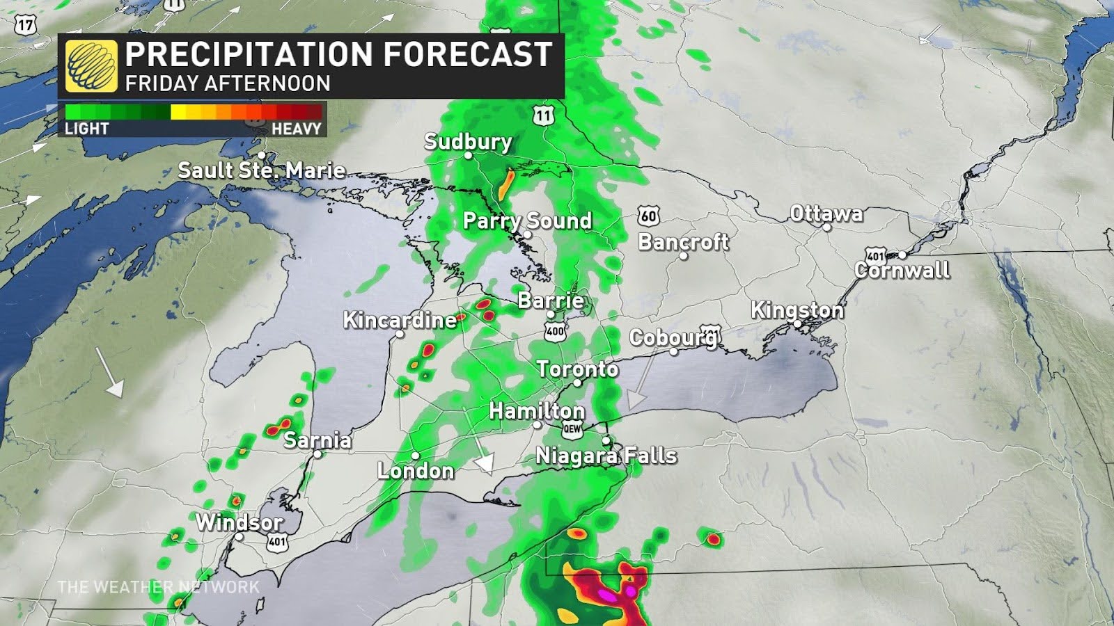
A showery Friday to close out the work week
Showers and thunderstorms will continue to sweep through southwestern Ontario Friday morning, with the system even extending into northeastern Ontario.
As the system loses steam during its trek eastward, the Greater Toronto Area (GTA) will escape with only some scattered, light showers throughout the afternoon.
Areas with the greatest risk for thunderstorms on Friday are around Georgian Bay, the western GTA, and southwestern Ontario. However, it is possible that isolated thunderstorms could pop up throughout most of the region as well.
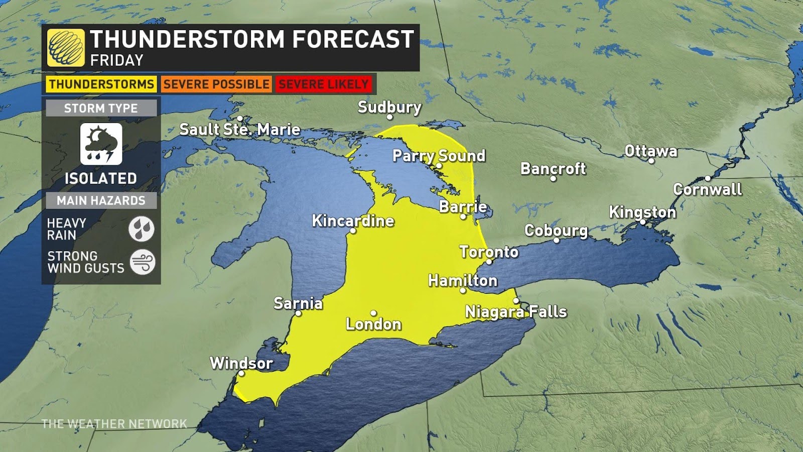
The main hazards we’re looking at with these isolated storms are heavy rain and gusty winds.
The work week will conclude with another low pressure system pushing into the region overnight Friday, bringing another round of scattered, light showers that will continue through early Saturday morning.
Check out our May outlook: Spring into summer or a stalling spring ahead, Canada?
Scattered showers continue through Saturday and Sunday
The remnants of Friday night’s showers will end early Saturday morning, leaving the GTA and the rest of the regions fairly dry for the day. To the north, around Cottage Country, Lake Huron shores, and eastern Ontario, we could see some light rain sprinkles throughout the afternoon.
Even though Saturday might stay dry, cloud cover will keep any weekend sunshine at bay.
The rain will return overnight Saturday, however, opening the doors to Sunday showers and another risk for thunderstorms.
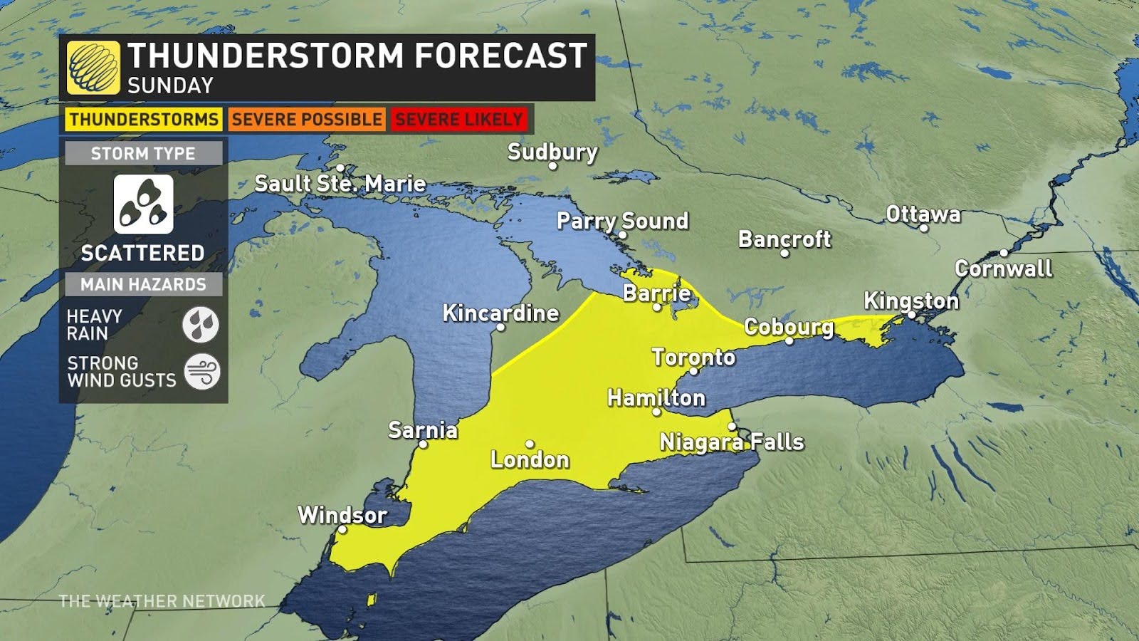
The rain and possible rumbles of thunder will meander over to the GTA through Sunday’s mid-afternoon hours before moving up to eastern Ontario in the evening.
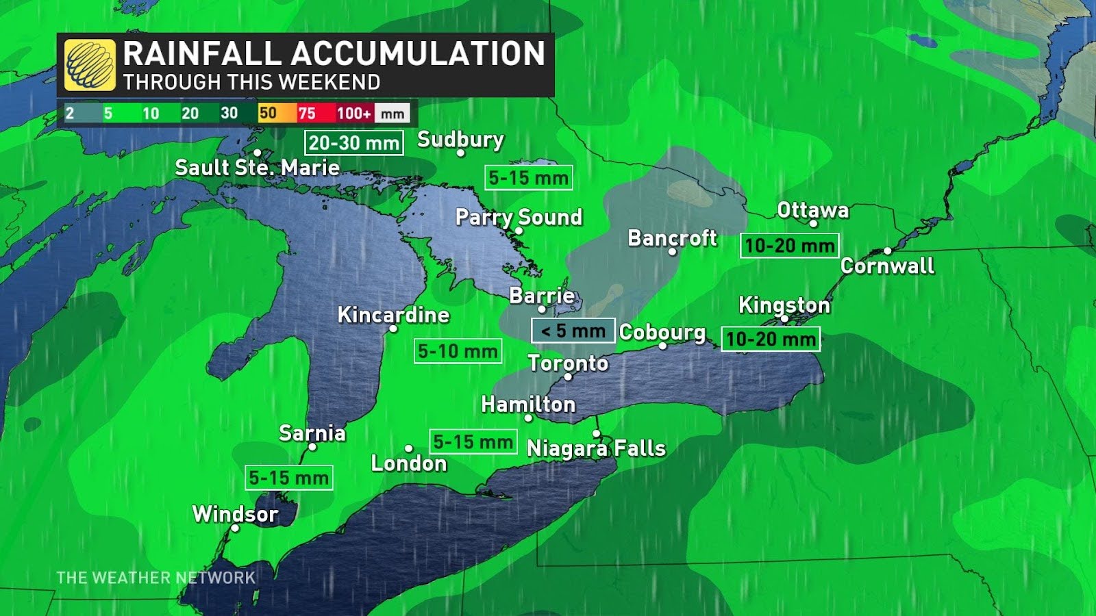
For the most part, the heaviest rainfall will stay to the north, around Sault Ste. Marie and Sudbury, where it is much needed.
Stay with The Weather Network for more forecast information and updates on your weather across southern Ontario.