Here’s where tornadoes and severe storms may be headed
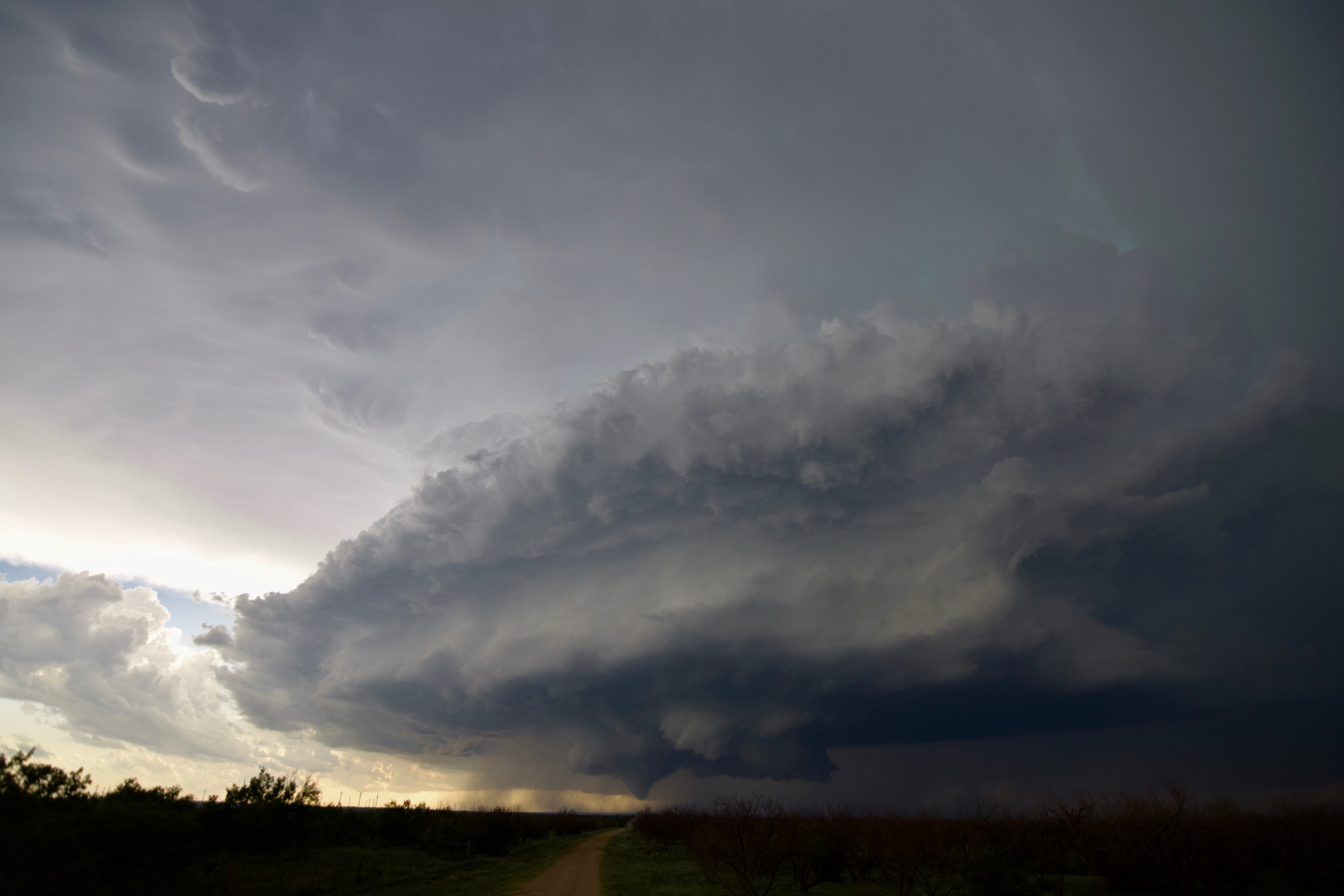
Severe weather season is in full swing, and that comes with the risk of a few tornadoes, perhaps significant ones, on Tuesday. The anticipated tornado event Monday over the Great Plains largely fell flat, but after a few overnight tornadoes in Kansas, more severe weather could be in the offing across the Corn Belt.
The Storm Prediction Center has already drawn a Level 3 out of 5 enhanced risk of severe weather around eastern Iowa, northeastern Missouri and northwestern Illinois, including Des Moines, Cedar Rapids and Iowa City. A Level 2 out of 5 risk reaches from Omaha to Kansas City, Mo., to Chicago, and as far south as the northern suburbs of Little Rock. As it stands, Kansas City saw a round of windy thunderstorms around 10:30 a.m. Tuesday.
“Large hail, damaging winds, and tornadoes should occur in this corridor,” wrote the Storm Prediction Center. It warned that — despite a morning round of storms — a second batch of afternoon storms could pose a greater severe weather risk.
More severe storms are possible across parts of Michigan and the northern Ohio Valley on Wednesday before the pattern quiets down some late week.
Tuesday’s risk
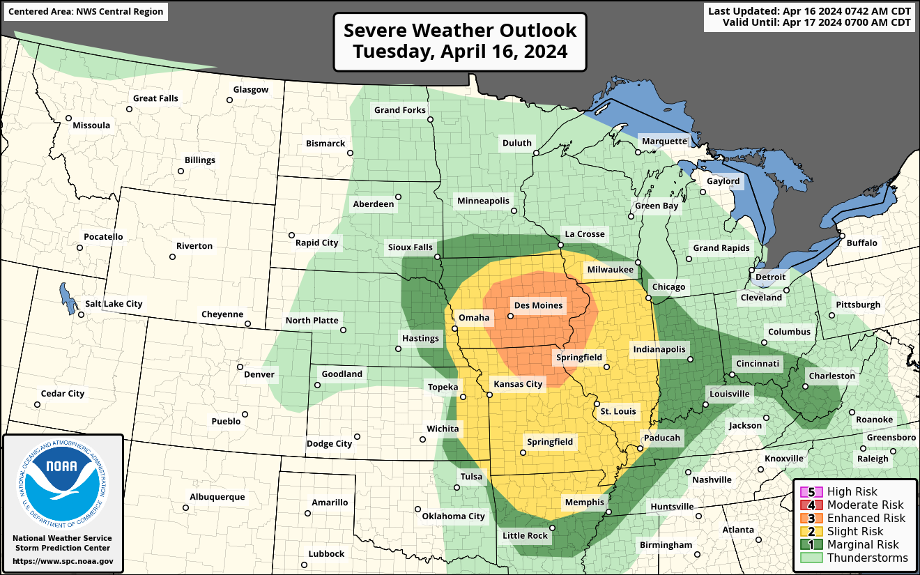
The Storm Prediction Center’s outlook for storminess on Tuesday. (NOAA/SPC)
A strong low pressure system was centered over northeastern Nebraska on Tuesday morning. Warm, moist air was lifting north ahead of it, allowing thunderstorms to blossom early in the day. Those storms were largely the leftovers of downpours and storms that formed overnight in Kansas before pushing east.
A few of those thunderstorms will intensify during the early afternoon as filtered sunshine heats the ground acutely. They will reach the Illinois border by suppertime.
A greater risk for severe thunderstorms, however, will occur along the leading edge of a cooler, drier air mass, which will arrive during the evening.
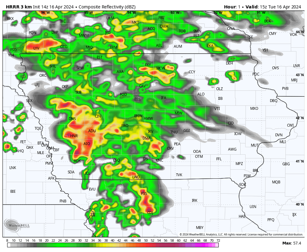
A look at a high-resolution model simulation of storms propagating through Iowa. (WeatherBell)
It’s unclear if morning thunderstorms will cut back on sunshine and inhibit additional heating, which is necessary to juice up and “reload” the atmosphere to prime it for severe late-day storms. That said, if thunderstorms do form in the afternoon across northern Missouri and south-central Iowa, they would be predisposed to becoming rotating supercell thunderstorms. That’s because wind shear, or a change of wind speed and/or direction with height, is present; any cells that span multiple layers of atmosphere could rotate.
Within any supercells that form late in the day, there will be the risk for a tornado, perhaps strong, as well as damaging straight-line winds and hail up to golf ball size.
An update on what happened Monday
Monday was advertised to feature a “conditional” risk for strong nighttime tornadoes — meaning the ingredients were present, but it was unclear whether storms would materialize. In the end, the event proved to be a bust from a tornado standpoint, though a few tornadoes appear to have touched down southwest of Topeka around 3 a.m. Tuesday.
Leading up to Monday’s anticipated event, meteorologists were worried that a lid of hot, dry air at the mid levels — known as a cap — would prevent surface air from rising, squishing storm prospects all day. That wound up being the case. It appears there was too much dry air at the mid levels, which became entrained in storm updrafts and shredded storms that did fire overnight.
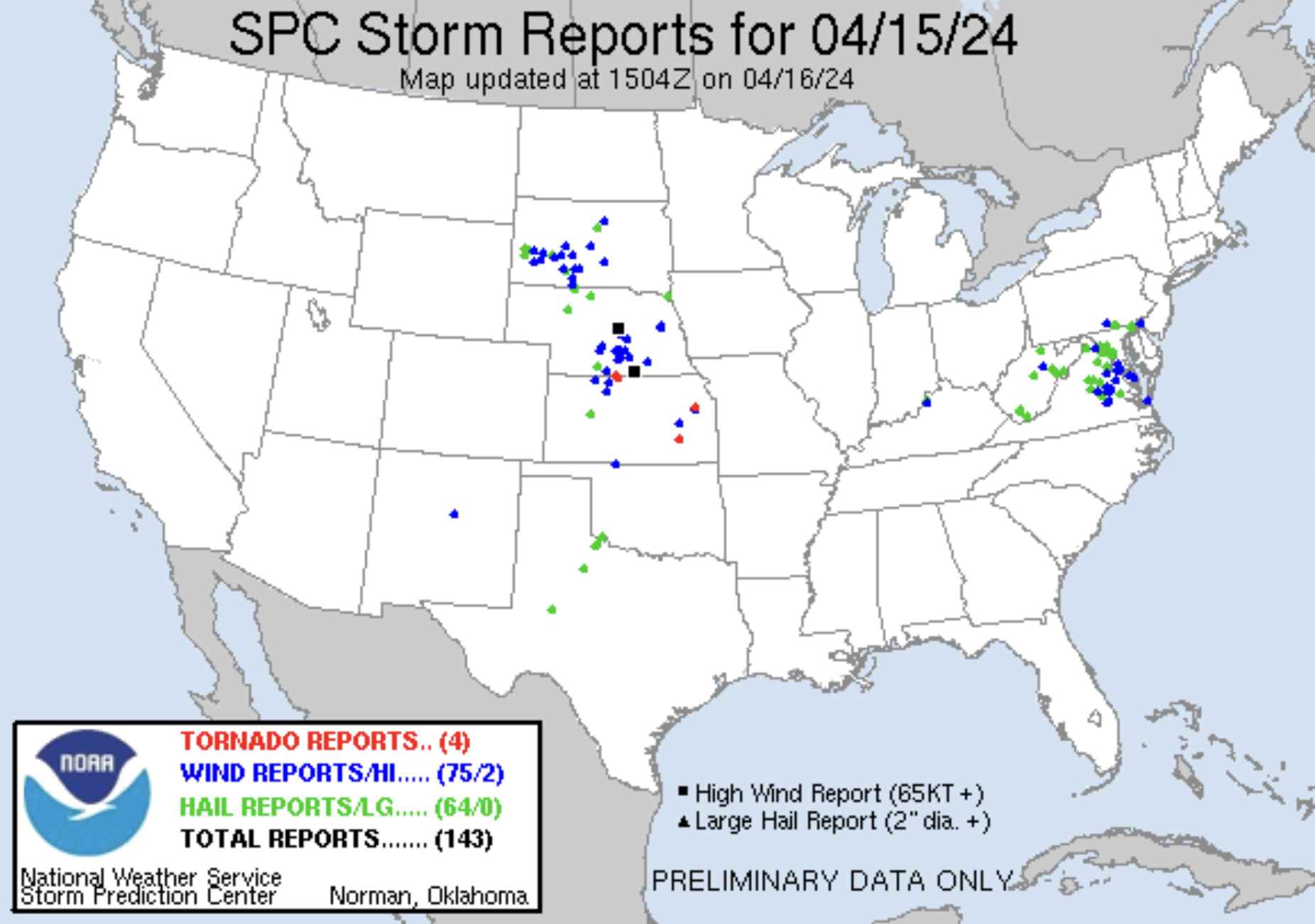
A map of storm reports from Monday and Monday night. (NOAA/SPC)
So despite plenty of storm fuel, storms were unable to form since rising air couldn’t break the cap. Farther north in Nebraska, there were rotating storms, but they were mostly too small to pose a tornado threat.
In Nuckolls County, Neb., a 78 mph wind gust was clocked as a meso vortex, or kink of rotation within a squall line. It passed overhead, but it does not appear that a tornado touched down.
Storm risk later in the week
After Tuesday, the risk of a few isolated storms shifts to the Midwest on Wednesday, primarily from Indianapolis to Detroit. That’s where a Level 2 out of 5 risk of severe weather has been drawn. Northern areas will have a better risk of one or two isolated tornadoes; farther south, subsidence, or broadly sinking air, will cut back on storm coverage.
By Thursday, the instigating cold front will become stalled and sort of strung out, leading to only a few gusty to locally severe thunderstorms, with wind and quarter-sized hail, from Evansville, Ind., to northeast of Dallas.
News Related-
Russian court extends detention of Wall Street Journal reporter Gershkovich until end of January
-
Russian court extends detention of Wall Street Journal reporter Evan Gershkovich, arrested on espionage charges
-
Israel's economy recovered from previous wars with Hamas, but this one might go longer, hit harder
-
Stock market today: Asian shares mixed ahead of US consumer confidence and price data
-
EXCLUSIVE: ‘Sister Wives' star Christine Brown says her kids' happy marriages inspired her leave Kody Brown
-
NBA fans roast Clippers for losing to Nuggets without Jokic, Murray, Gordon
-
Panthers-Senators brawl ends in 10-minute penalty for all players on ice
-
CNBC Daily Open: Is record Black Friday sales spike a false dawn?
-
Freed Israeli hostage describes deteriorating conditions while being held by Hamas
-
High stakes and glitz mark the vote in Paris for the 2030 World Expo host
-
Biden’s unworkable nursing rule will harm seniors
-
Jalen Hurts: We did what we needed to do when it mattered the most
-
LeBron James takes NBA all-time minutes lead in career-worst loss
-
Vikings' Kevin O'Connell to evaluate Josh Dobbs, path forward at QB