The latest bout of disruptive, wintry weather in northwestern Ontario is due to a sluggish Colorado low that has been plaguing the region since Sunday.
Road conditions have been treacherous since then, and will likely remain difficult through the day Wednesday, despite snow winding down in the morning, as crews continue the cleanup efforts.
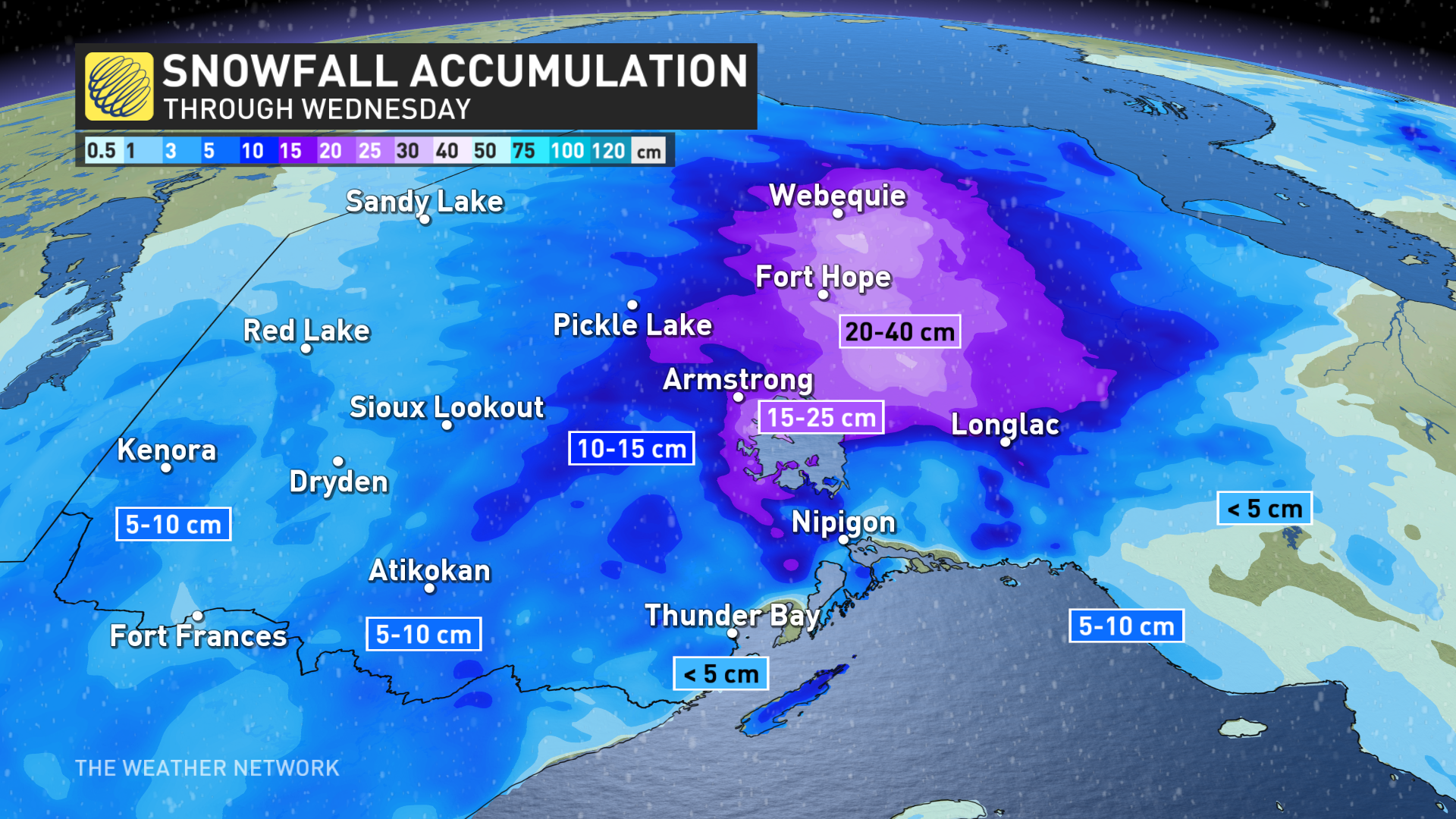
By the time the system finally exits, some areas could see 30-40 cm of snow including Thunder Bay, Nipigon and Marathon, with others north of Lake Superior possibly seeing as much as 50 cm.
Avoid non-essential travel until conditions improve. As well, take frequent breaks and avoid strain when clearing snow.
Wednesday: Snowfall starts to wind down, but road conditions remain poor
After the heaviest snowfall rates fell Tuesday, snow will lighten by Wednesday morning for most areas but will remain moderate for locales north of Armstrong.
Going somewhere? Check out the current highway conditions before heading out!
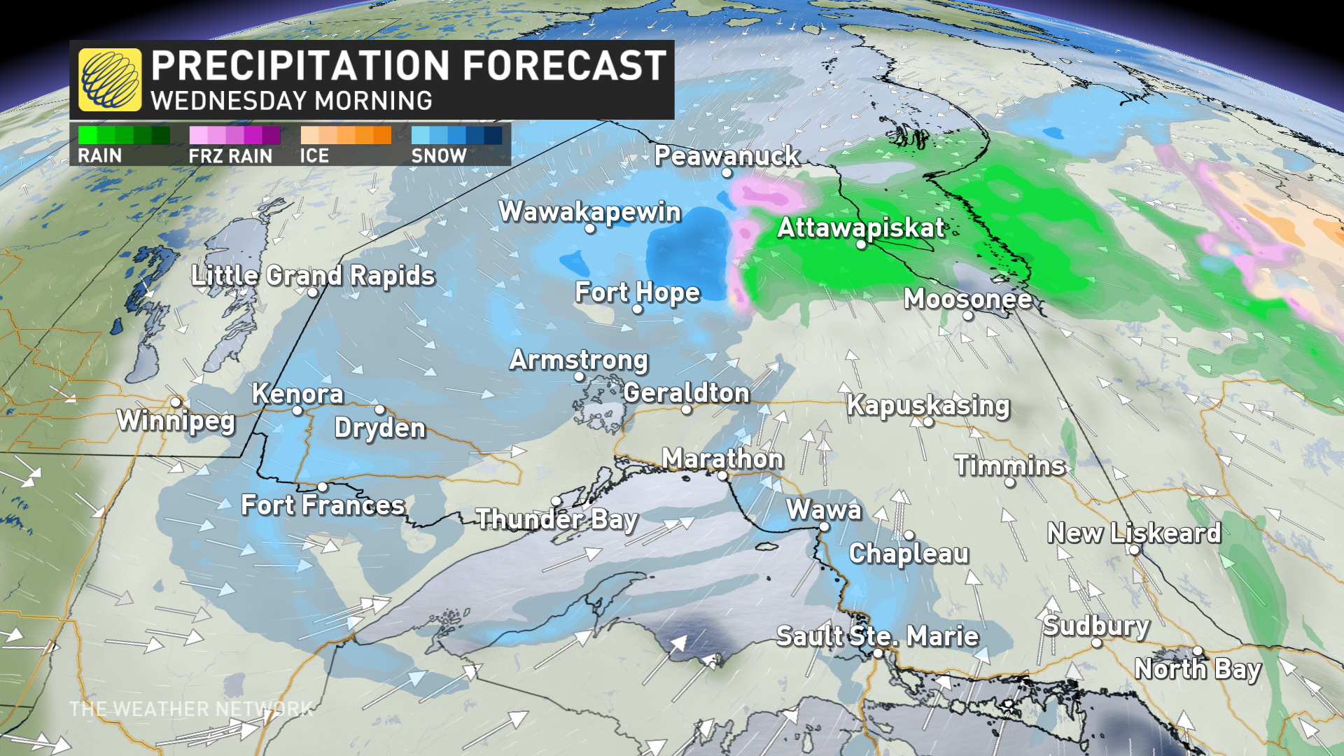
In addition to the falling snow, gusty winds between 40-60 km/h will linger Wednesday morning before easing. That will lead to poor visibility on the roads, so prepare for tough commutes during the day.
By the time it wraps up Wednesday, between 30-40 cm of snow is forecast for areas including Thunder Bay, Nipigon and Marathon, with some areas north of Lake Superior possibly seeing as much as 50 cm by the time.
DON’T MISS: Canada’s widespread drought may fuel the upcoming wildfire season
Travellers can expect hazardous road conditions on Wednesday still, especially along the Trans-Canada Highway and Highway 11.
Road closures and travel delays are still likely on Wednesday morning, as are school and business closures. Consider postponing non-essential travel until conditions improve.
Deepest seasonal snowpack likely for Thunder Bay
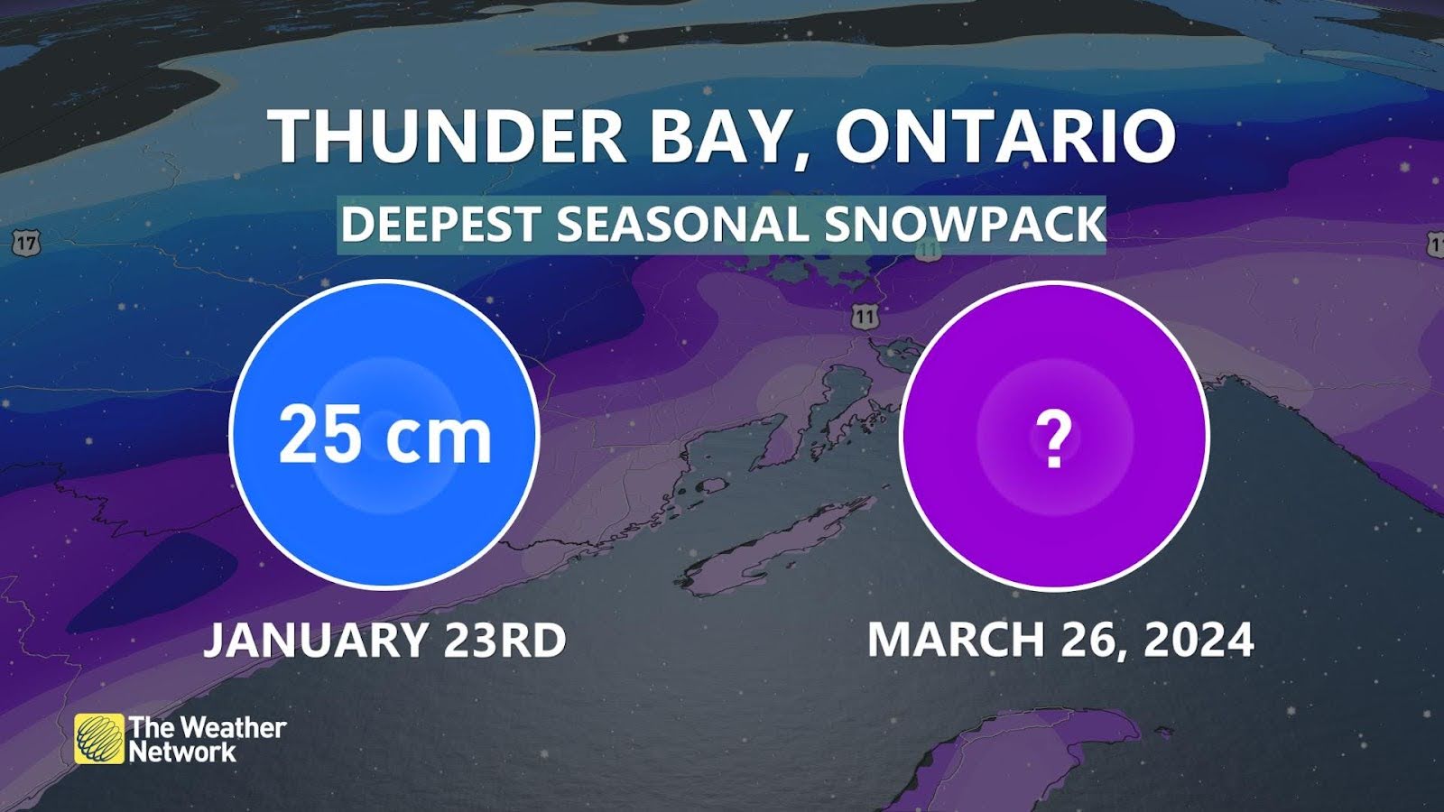
Thunder Bay is one of many communities across Canada affected by a snow drought this season. The city witnessed a rare green Christmas in December 2023, and the deepest snowpack at the airport only amounted to 25 cm at the end of January 2024.
STAY SAFE: Be aware of your heart while shovelling heavy snow
The onset of spring is no match for a far-reaching storm. Early spring storms can generate more bountiful snows than their mid-winter counterparts because of the abundance of tropical moisture surging north out of the Gulf in March and April.
Be sure to check back for the latest weather updates across northern Ontario.