Maps show forecast snow totals, timing of storm on Tuesday
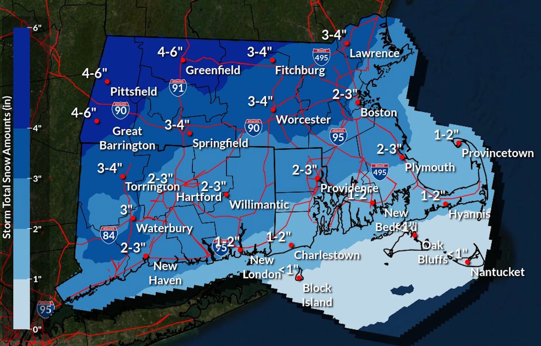
Snowfall estimates for Southern New England.
Another round of snow is forecast to start overnight Monday into Tuesday, leading to some slick roads for both the Tuesday morning and afternoon commutes throughout New England. About 1 to 3 inches of snow is expected in the Boston area, more in higher elevations and in Northern New England, according to the National Weather Service.
All of New England, except for southeastern Massachusetts and northern Maine, is under a winter weather advisory from Monday night until Tuesday evening due to the potential for hazardous road conditions.
Light snow will start shortly after midnight and “will pick up a little bit between 7 and 10 a.m., with light to moderate snow,” Frank Nocera, a meteorologist with the NWS in Norton, said Monday.
“By 7 a.m., there could be an inch or two of snow on the ground,” he said. “There will definitely be some travel impacts.” Temperatures will start out in the high 20s in the morning in Boston and top off briefly at 35 degrees before plummeting back into the 20s, according to the NWS.
The snow will then change over to several hours of sleet and possibly some freezing rain during the late morning to mid-day along and west of Interstate 95, and to all rain south and east of I-95, the Weather Service said. Precipitation will wind down between 4 and 6 p.m. and conditions should improve for the late-afternoon commute, according to the NWS.
These maps show how much snow we can expect to see and when in New England:
Massachusetts
Rhode Island
New Hampshire and Maine
Northern New England, including New Hampshire and Maine, are forecast to receive anywhere from 2 to 8 inches of snow from this storm. Northern Maine is under a winter storm warning Tuesday.
Vermont
Connecticut