The first day of spring was more akin of winter in Eastern Canada, with snowfall and cold temperatures in southern Ontario, and wintry weather in eastern Quebec and northern New Brunswick, as well.
The light serving of snow for the latter two regions served as an appetizer for the next disturbance that will be fairly impactful on Thursday, expanding its coverage into Newfoundland and Nova Scotia, too.
SEE ALSO: Quebecers can legally remove winter tires soon, but should they?
A swath of heavy snow and strong winds will be dragged along with the lows into eastern Quebec and northern New Brunswick. Anywhere from 15-30 cm of snowfall is expected through Friday morning. Winter storm and snowfall warnings are in place across eastern Quebec. Prepare for quickly changing and deteriorating travel conditions.
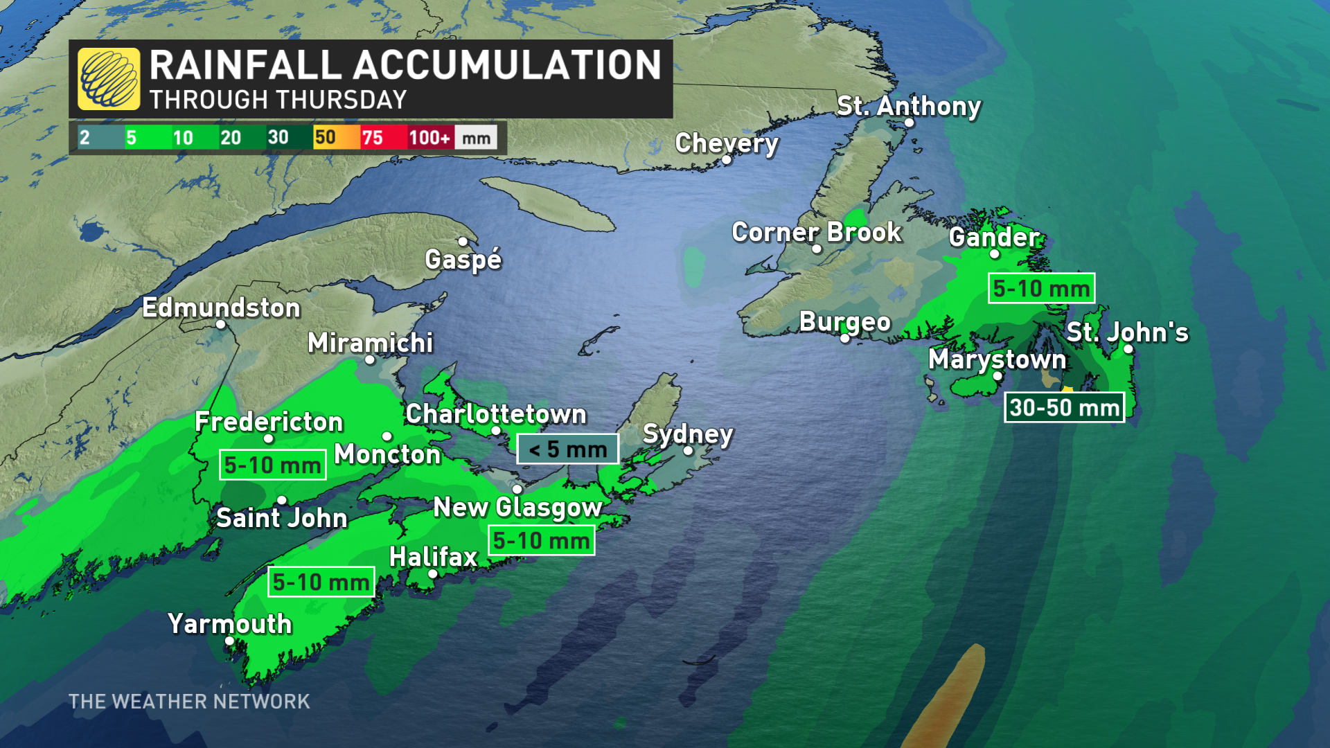
Meanwhile, parts of Newfoundland could see 30-50 mm of rain, prompting warnings to be issued.
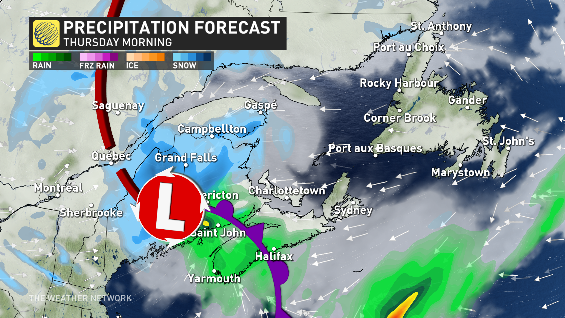
Through Friday morning: Heavy snow, blustery winds and soaking rains for some
A clipper will develop and track in from New England, and will have wintry impacts for parts of Eastern Canada through into Friday morning, bringing widespread, windy conditions, and heavy snow for northern New Brunswick, parts of eastern Quebec and western Newfoundland.
Meanwhile, the Avalon and Burin peninsulas will be hit with 30-50 mm of rainfall.
Snow will accumulate rather quickly, so conditions will change in a hurry. If you need to be on the roads, consider shifting plans to avoid the worst of it while driving.
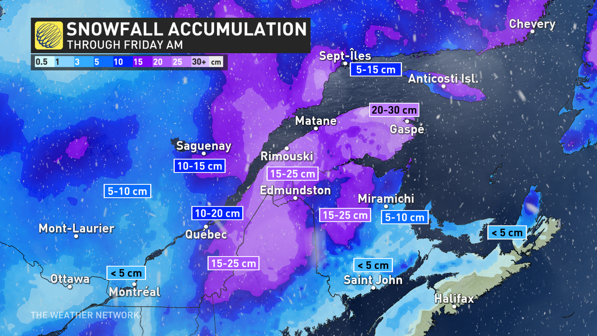
The heaviest snowfall for Quebec City and the Eastern Townships will be from Wednesday overnight into Thursday afternoon, with Quebec City likely to see around 10 cm of snow. For northern New Brunswick and the Gaspé Peninsula, the worst of it will be Thursday morning and afternoon.
Snowfall rates will range from 1-3 cm an hour on average, but in intense bands, they could reach as high as 5 cm an hour.
Flurries will linger overnight Thursday and through Friday morning before easing for the afternoon.
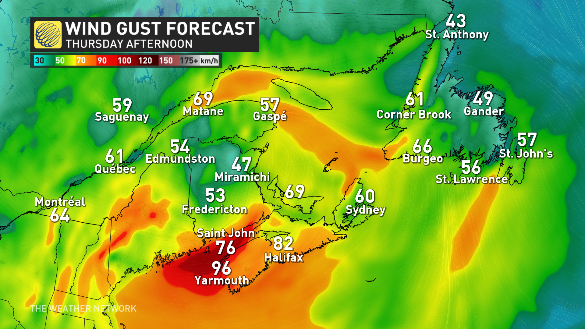
Wind gusts will pick up through the day Thursday, ranging from 40-60 km/h, meaning poor visibility on the roads, so travel is not recommended.
Southwest Nova Scotia and the Bay of Fundy will be even more battered by the winds on Thursday, with gusts reaching 70-90+ km/h.
As the system moves northeast through Thursday afternoon, folks on the Avalon and Burin peninsulas can expect to see heavy rain rather than snow. With 30-50 mm of rain in the forecast, rainfall warnings have been issued for the Avalon and Burin.
Beyond, forecasters are closely watching the track of a storm that is expected to track up the U.S. East Coast this weekend and reach Atlantic Canada, with mostly rain for southern areas, snow for northern areas and a messy mix of snow, rain and possibly ice in between.
The track and impacts of this system will highly depend on whether this storm merges with the system that tracked across southern Ontario. Another messy system is expected early or the middle of next week with a risk for freezing rain for parts of the Maritimes.
Stay tuned to The Weather Network for the latest forecast updates for Eastern Canada.