Anomalously potent May storm will hit the Prairies with drenching rains, winds
A pleasant weekend is on tap for much of the Prairies as calm conditions and comfortable air bathe the region.
Take advantage of it while you can. A hefty storm will arrive on Monday with widespread heavy rain and gusty winds. Foul conditions will last for several days as the storm moves through the area, especially on the southern Prairies.
YOUR MAY OUTLOOK: Spring into summer or a stalling spring ahead, Canada?
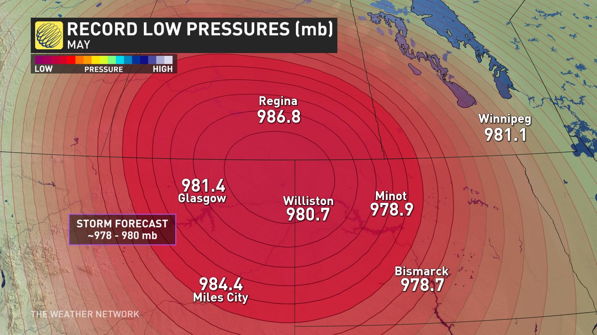
In fact, with the unusual steep pressure drop expected with the inbound system, there is the chance of it becoming the strongest May storm in that part of North America.
Potent storm begins on Monday
An upper-level low swinging down the West Coast this weekend will make a turn toward the Prairies just in time for the new work week.
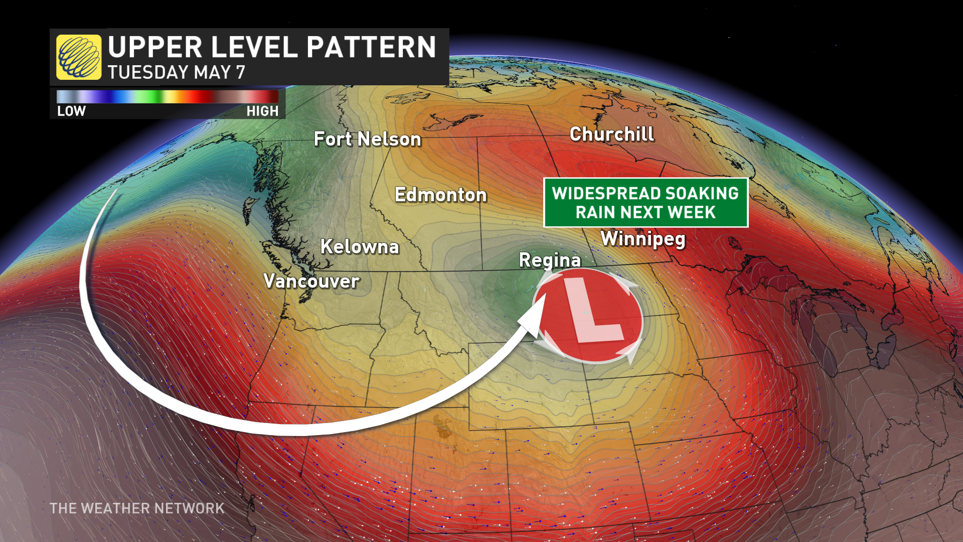
This pattern will give rise to a formidable centre of low pressure that’ll strengthen as it approaches the southern Prairies.
The low will form, strengthen and then park itself over a vast area that stretches across Montana North Dakota and Saskatchewan, from Sunday through early Wednesday.
The storm is expected to have its pressure drop below 980 millibars, which would make it the strongest May storm for that part of North America.
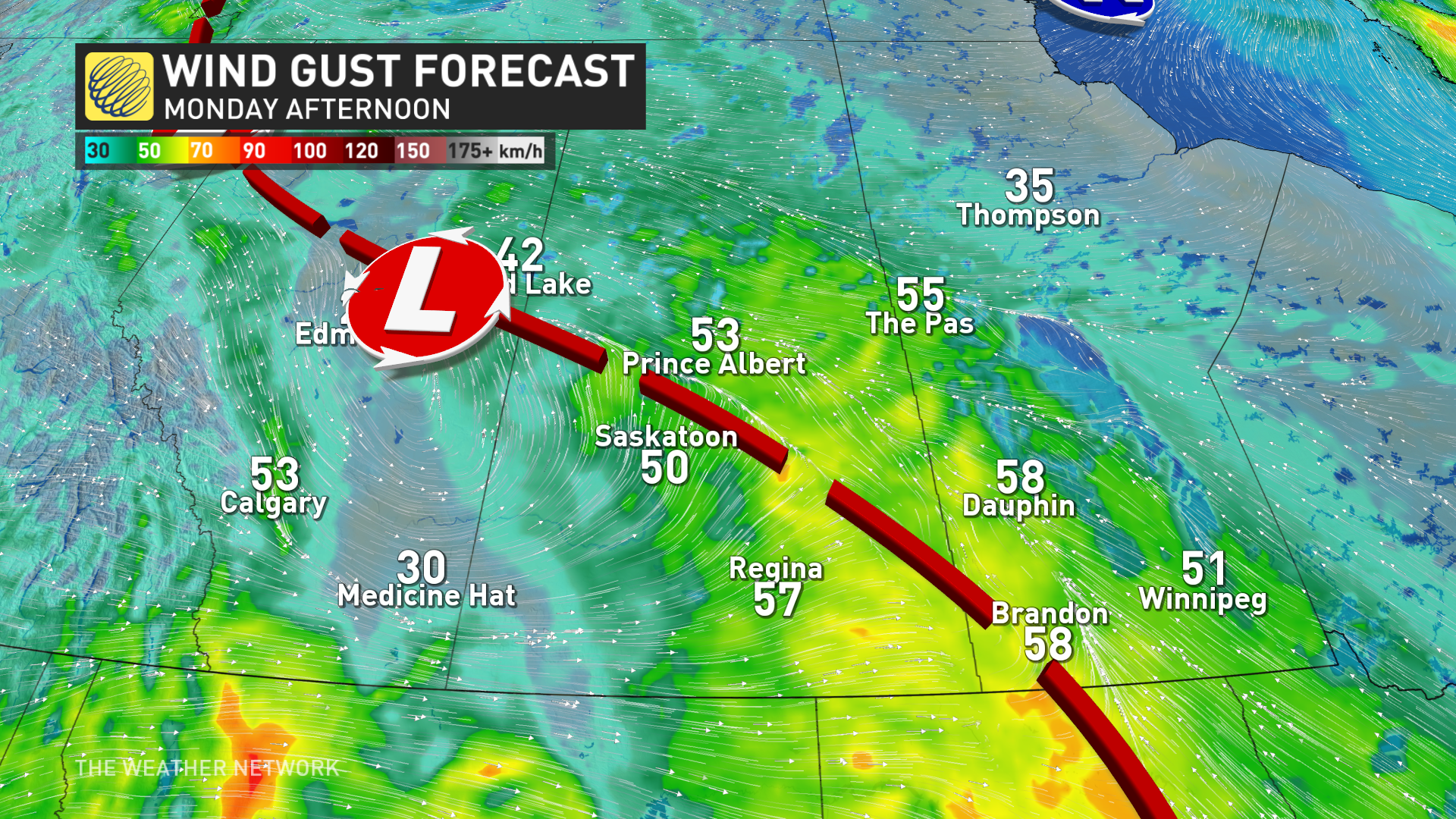
Because of the unusually low pressure and strength, the storm will produce blustery winds and heavy rain for several days.
Heaviest rain arrives Tuesday, lingers into Wednesday
We’ll see scattered rain push into southern portions of Alberta and Saskatchewan on Monday morning, with persistent rain covering the region by the evening hours.
Rain will start pushing into southern Manitoba through the overnight hours Monday into early Tuesday.
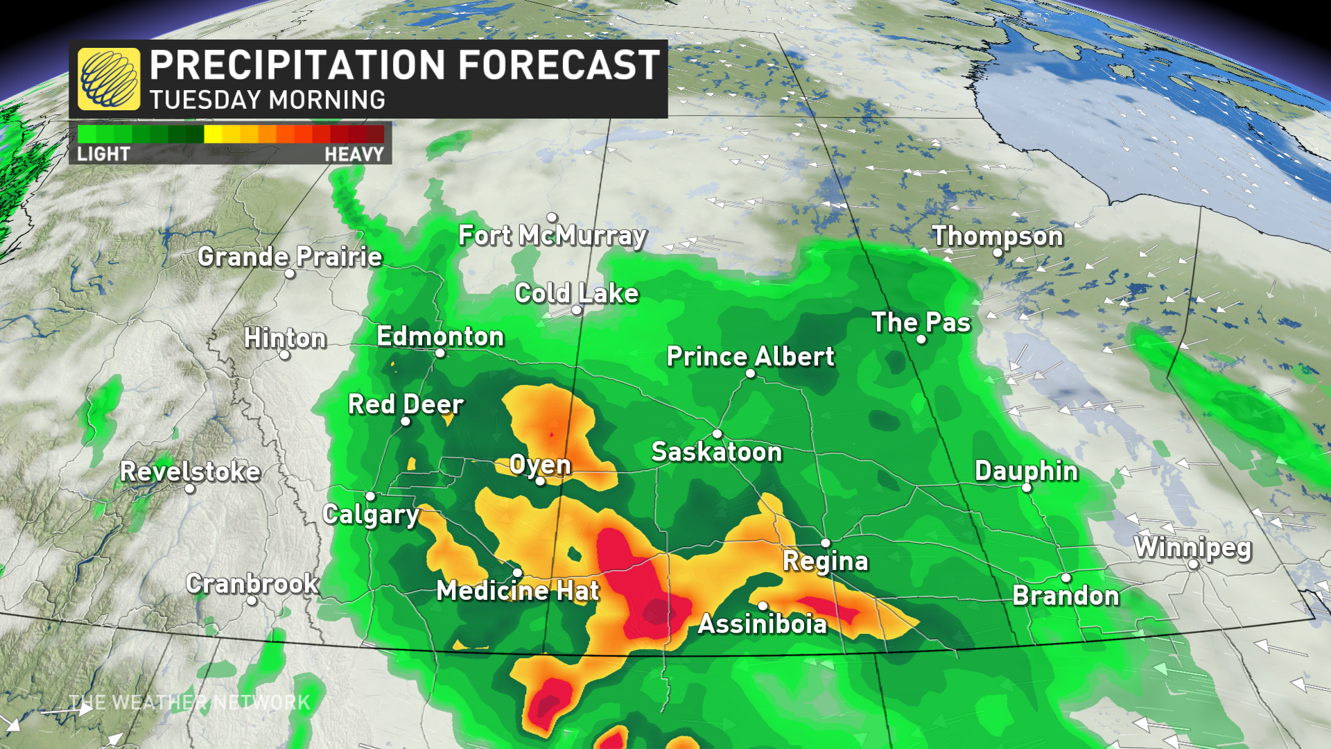
Widespread soaking rains will blanket the southern half of the Prairies through the day Tuesday, with the event’s heaviest rainfall rates affecting portions of eastern Alberta and western Saskatchewan.
Persistent heavy rainfall could lead to flooding issues in vulnerable areas. Remember, never try to drive across a flooded roadway. It’s impossible to tell how deep the water is until it’s too late.
Wind gusts of 50-70 km/h could accompany the heavy rainfall at times. The combination of gusty winds and rain-soaked soil could lead to isolated power outages.
SEE ALSO: May is here, along with all its Canadian weather extremes
Rain will continue into Wednesday as the system finally wraps up its tour of the southern Prairies. Folks across southern Manitoba will see precipitation taper to scattered showers by Wednesday morning, with the rain finally easing for Alberta and Saskatchewan into Wednesday night.
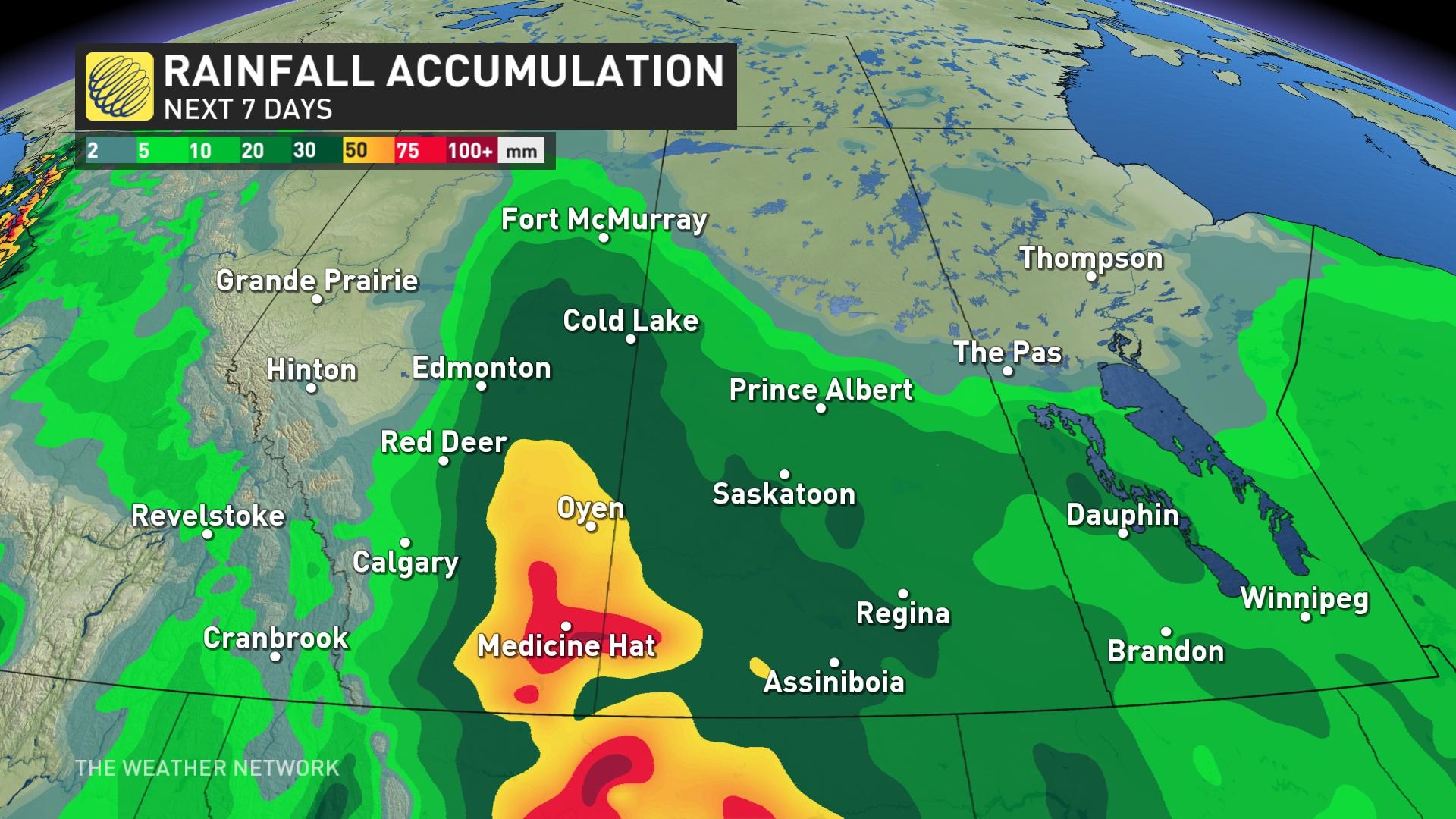
All told, widespread rainfall totals of 30-50 mm are in the forecast throughout the southern half of the Prairies. Locally higher totals of 50-75+ mm are possible in southeastern Alberta.
Stay with The Weather Network for your latest forecast across the Prairies.