Hurricane Beryl Spaghetti Models Show New Threat to Texas
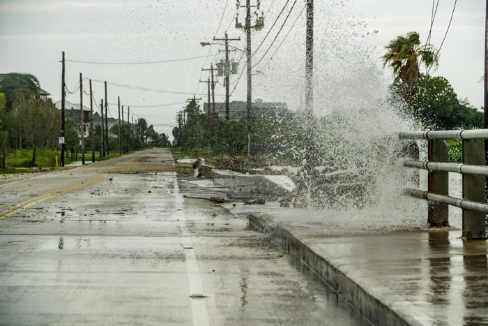
Water crashing over a road near Galveston Bay just outside of Houston Texas during Hurricane Harvey. Hurricane Beryl is now categorized as a Category 5 hurricane. Some impacts could be felt in Texas by the weekend.
Some spaghetti models for Hurricane Beryl show the potential for the storm's impacts to affect Texas by this weekend.
Beryl strengthened into a hurricane on Saturday, becoming June's eastern-most major hurricane in the Atlantic. The storm underwent rapid intensification, and it became a Category 4 hurricane as soon as its wind speeds reached 130 miles per hour.
The system temporarily weakened to a Category 3 before strengthening again, with maximum winds documented at 150 miles per hour when it made landfall in the Windward Islands on Monday morning.
Since Monday, Beryl has continued to strengthen and is now categorized as a Category 5 with maximum sustained windspeeds of 165 miles per hour.
Spaghetti models, or computer models illustrating potential storm paths, show the storm reaching Jamaica by Wednesday afternoon as a Category 3 hurricane.
The current forecast path projects it through the Cayman Islands and then again making landfall south of Cancun, Mexico as a Category 1 hurricane and then moving into the Bay of Campeche, where it is expected to weaken to a tropical storm. However, some models anticipate impacts in southern and southeastern Texas and potentially the Louisiana coast by this weekend.
AccuWeather issued a warning that "Beryl could bring some rain and wind impacts to southern Texas this weekend, with a lower risk of impacts from Houston and points east," according to a recent forecast.
AccuWeather meteorologists said, "There is a low chance that Beryl would have direct impacts on the United States," with the greatest chance around Corpus Christi, Texas, but that downpours are possible, particularly in southern Texas if the storm makes landfall in northern Mexico.
"It is very important to note that if the high pressure across the Southeast weakens, that can allow the storm to move farther north and potentially directly impact the Gulf Coast," AccuWeather lead hurricane forecaster Alex DaSilva said.
A rip current statement is already in place for parts of southern Texas. National Weather Service (NWS) meteorologist Israel Gonzalez previously told Newsweek that hurricanes can cause rip currents hundreds of miles away.
Newsweek has reached out to the NWS office in Brownsville, Texas, by phone for comment.
Other meteorologists are urging people to be on their guard should the storm shift its path.
"If I'm watching from Texas or even Louisiana, the threat level still appears *low*; but model guidance(Euro&GFS Ensembles) showcases why we can't discount a scenario where this system brings impacts the NW Gulf Coast," Scot Pilié, a meteorologist in New Orleans, posted on X, formerly Twitter.
WFLA-TV Chief Meteorologist Jeff Berardelli also shared a post regarding the storm's potential path.
"#Beryl is headed into the western Caribbean, should weaken some before passing near Jamaica. Florida will be protected by a high pressure ridge/heat dome. But that dome will shift, possibly allowing the storm to head closer to N. Mexico or Texas in longer range. Worth watching!" he posted on X.
Start your unlimited Newsweek trial