Threat of severe storms and tornadoes returns to central states
Threat of severe storms and tornadoes returns to central states
After a brief respite, severe weather season is set to roar to life once again. Tornadoes, damaging winds and hail are possible across portions of the central and southern Plains over the next several days, with the possibility of a more widespread threat of severe weather next week.
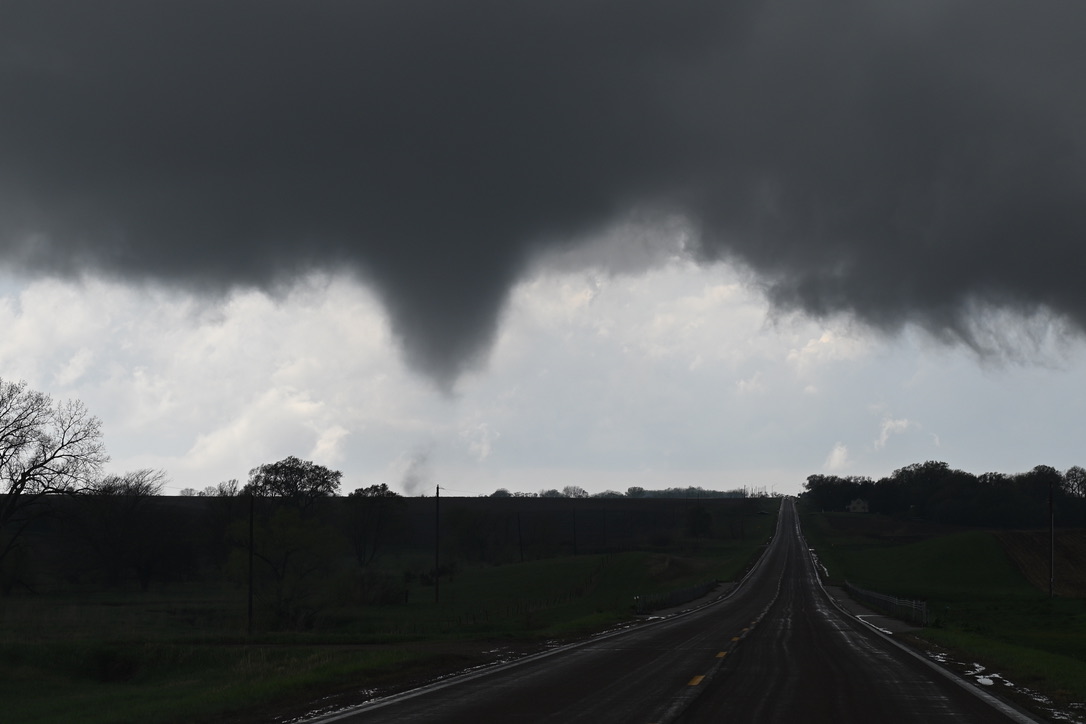
Some of the areas at risk include those hit Friday and over the weekend. Back-to-back tornado outbreaks ravaged Nebraska, Iowa and Oklahoma, with 106 tornadoes reported over the central states since Thursday. The National Weather Service rated eight of them EF3 on the 0-to-5 Enhanced Fujita Scale for intensity, meaning they had winds estimated at over 135 mph.
Marietta, a town in southern Oklahoma along Interstate 35, endured EF4 damage, with winds estimated at up to 170 mph. It was the first EF4 twister to hit the Sooner State since 2016.
April has featured at least 280 tornadoes so far, the second most on record for the month. And May looks likely to get off to an active start.
Storm chances Tuesday
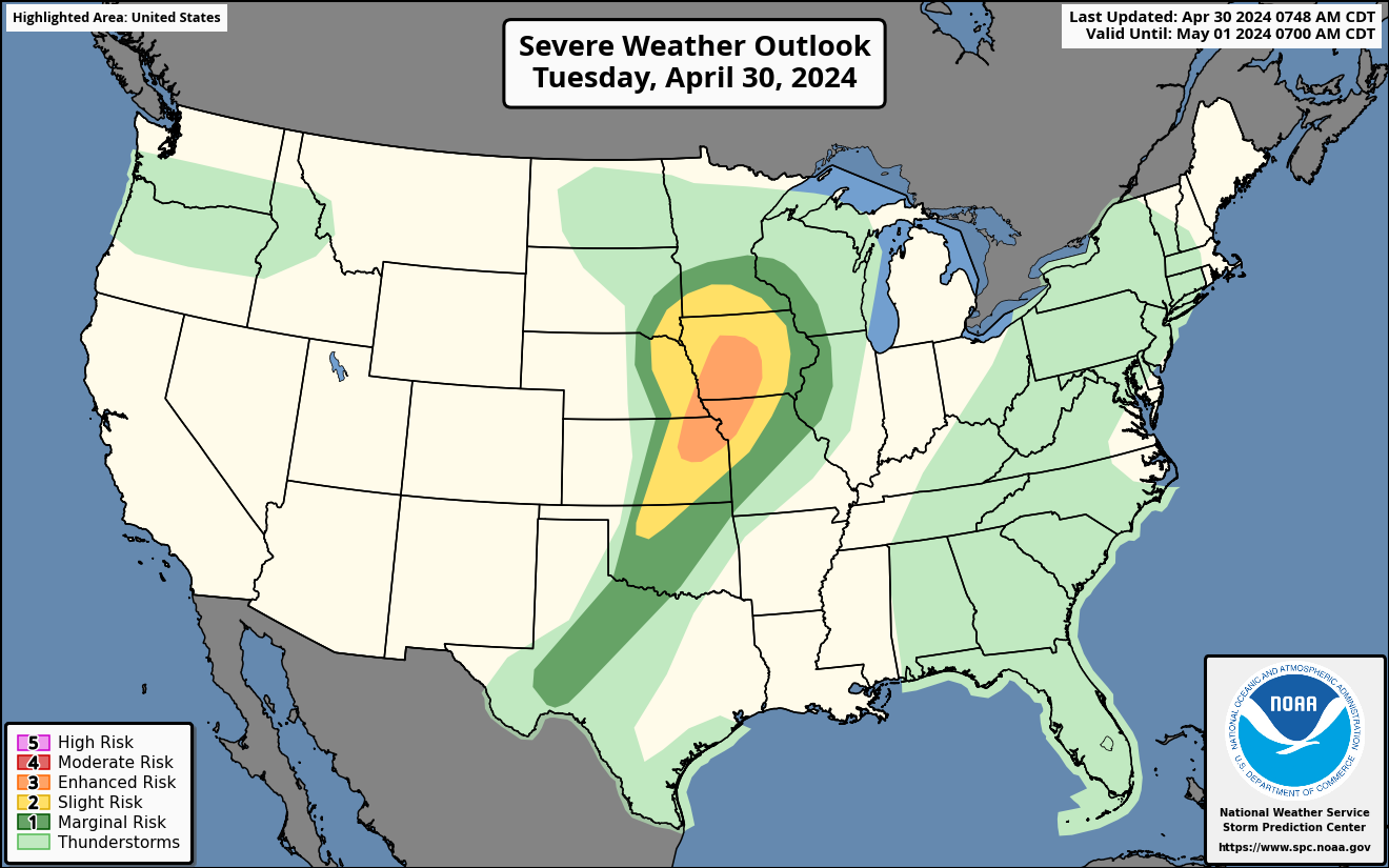
The Storm Prediction Center’s outlook for storms on Tuesday. (NOAA/SPC)
On Tuesday, a Level 3 out of 5 risk of severe weather covers northeast Kansas, northwest Missouri, southeast Nebraska and a swath of Iowa. The Kansas City area; Topeka, Kan.; Lawrence, Kan.; and Des Moines are in the Level 3 zone.
A Level 2 risk stretches from northwest Oklahoma to southern Minnesota, and includes Omaha and Sioux Falls.
Storms will develop as a low-pressure system swings through southern Minnesota, while a cold front extends southwestward through Kansas and northeast Colorado.
Ahead of the front, a corridor of warm, moist air will work northward. That will contain thunderstorm fuel and support storm formation in eastern Nebraska, southwest Minnesota and western Iowa during the mid- to late afternoon. Storms could reach Des Moines between 5 and 7 p.m. and will probably extend south toward Kansas City just a little later.
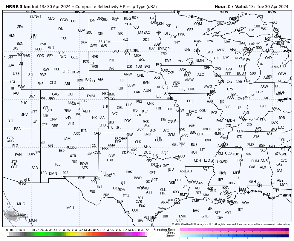
A high-resolution model simulation of storms over the Plains on Tuesday. (WeatherBell)
More moisture will be available to the south, but the best shear — a change of wind speed and/or direction with height that helps storm spin — will be present to the north. That means that the tornado risk is uncertain. Large hail and damaging straight-line winds are more probable hazards.
There are signs that flooding, perhaps significant, could hit southeast Kansas on Tuesday evening. The front generating the storms will slowly sag south and stall, allowing them to train, or move repeatedly, over some areas. That risk will be greatest east of Wichita and south of Emporia, where a flood watch is in effect.
Wednesday’s storms
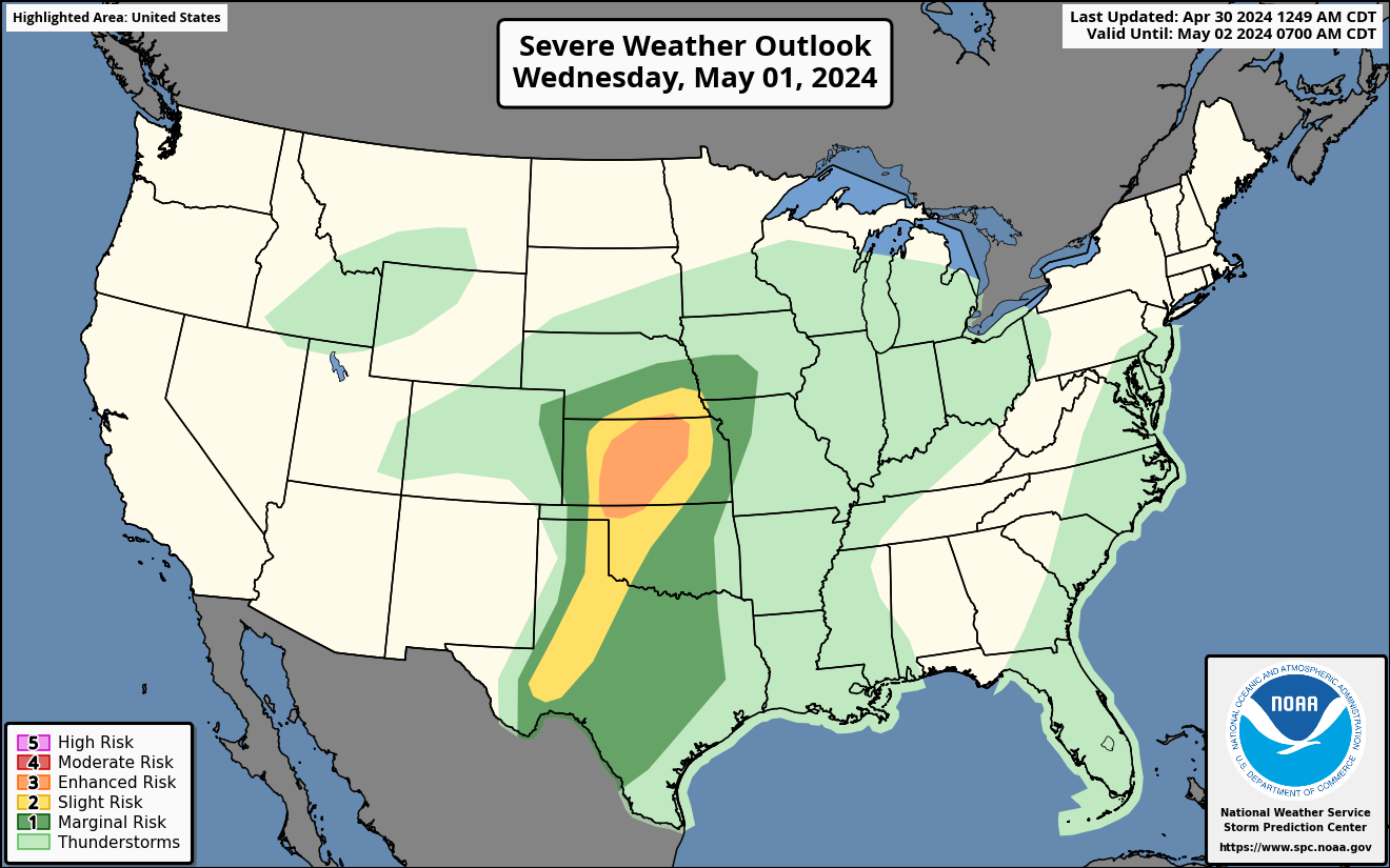
The Storm Prediction Center’s outlook for Wednesday. (NOAA/SPC)
The severe weather risk may increase Wednesday. A Level 3 risk covers central Kansas, including Manhattan, Salina, Hutchinson, Dodge City and Hays, plus a sliver of north-central Oklahoma. Then a Level 2 risk stretches from Lincoln, Neb., through the Permian Basin of Texas, including Midland-Odessa and Fort Stockton.
Scattered thunderstorms are predicted to form east of a dryline — the leading edge of bone-dry air from the Desert Southwest — extending from the Oklahoma Panhandle into western Texas.
Storms may be most numerous and severe along a warm front in Kansas where wind shear will also be heightened, increasing the tornado risk.
Late this week into next week
There are broad signs of severe weather chances somewhere across Kansas, Nebraska or Iowa into Thursday, but it’s too early to pin down specific locations most at risk.
Severe weather chances look to ease by the weekend, but indications are that they could return, perhaps dramatically, on Monday and Tuesday.
Again, it’s too early to offer details, but the pattern simulated by computer models is a classic one for significant severe weather.
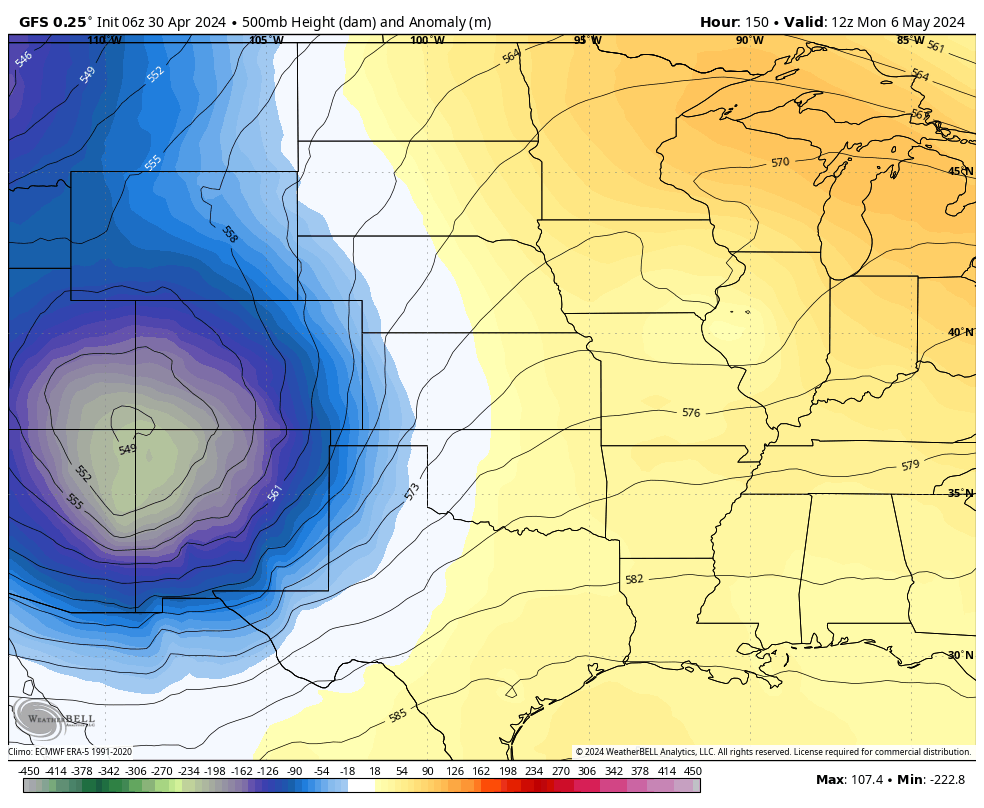
The American GFS model simulates a strong disturbance encroaching onto the Plains early next week. (WeatherBell)
An approaching jet stream dip, filled with cold air aloft, will swing in from the west. At the same time, warm, moist air and abundant storm fuel will spread through the Plains from the Gulf of Mexico.
If this pattern holds, as these contrasting airflows collide, severe storms containing damaging winds, large hail and tornadoes can be expected. More details will work themselves out in the days ahead.
Jason Samenow contributed to this report.