Storms, flooding coming this weekend
The unrelenting rain that has lingered over Sydney for weeks is forecast to stick around, with widespread rain and thunderstorms also forecast for other parts of the country.
Sydney is reportedly just half way through a two-week stretch of rainy days, with about 130mm of rain recorded at the Sydney Observatory in the first seven days of May.
A “stubborn high pressure system” is keeping a large amount of moisture the atmosphere over the east of the country this week, WeatherZone reports.
Storms, flooding coming this weekend
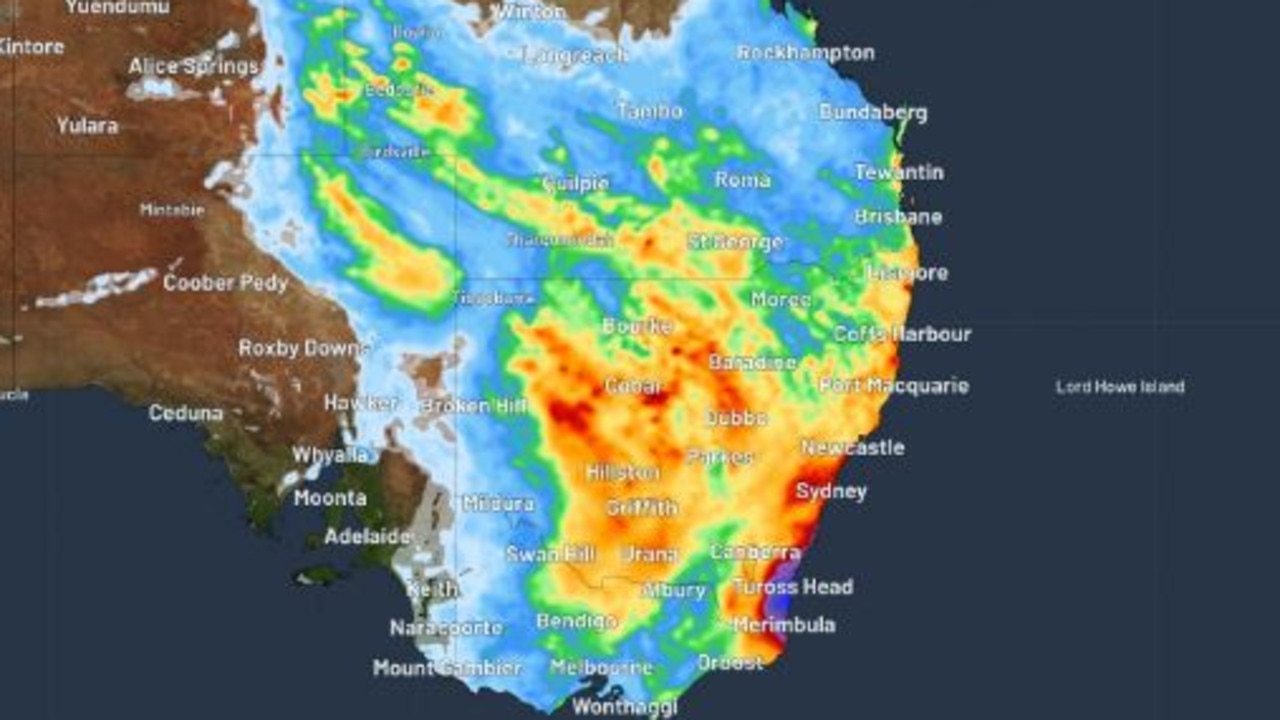
Wet weather is expected to hit multiple states heading into the weekend, including NSW and Qld, the northeast of SA and southern parts of the NT.
Thunderstorms could develop across NSW, southern Qld and parts of Victoria and WA from Friday to Sunday.
On Friday, most of the heavy rainfall totals in the eastern part of the country will be in the interior of NSW and potentially southern Queensland, Sarah Scully, senior meteorologist at the Bureau of Meteorology, said.
“Widespread rainfall totals of 10 to 40mm are expected but even high totals of 50 to 80mm, more isolated, are possible,” she said.
Ms Scully said that residents in the Warrego river area in NSW should stay up to date with the forecast and warnings.
“The Warrego River in NSW is already in moderate flooding so we know that any further rainfall over that catchment will respond really quickly,” she said.
From Friday afternoon, rain will develop in the southern half of the NSW coast, with the weather set to ramp up over the eastern part of the state on Saturday to make for a wet weekend.
There is the potential for 100 to 150mm of rain in the southern half of NSW between Thursday and Sunday night, with the possibility of up to 200mm in some parts, while the rainfall totals inland are predicted to be between 50 and 100mm.
The most significant rainfall in the coming days is forecast in the Illawarra, with the Bureau of Meteorology expecting to issue a severe weather warning on Friday.
Flood warnings are also likely to be issued as the weekend approaches, with locals and weekend visitors warned to factor this into their travel plans.
Over in WA, severe thunderstorms are predicted in south western parts of the state for Friday, bringing an end to WA’s unseasonably warm week, which included high fire danger ratings across much of the state.
Rain and thunderstorms are predicted over the next few days from Geraldton, down past Perth, down towards Albany, Angus Hines, senior meteorologist at the Bureau of Meteorology said.
“These places, across the south west, if you do see severe thunderstorms on Friday, could come with heavy rain which could cause areas of flash flooding, could come with damaging winds, which can bring down trees and cause power outages,” Mr Hines said.
“The potential is even there for some large hail, which can damage property and can damage crops as well.”
Despite the wet weather forecast, some parts of the country are in for some relief, with the bureau forecasting that below average rainfall for most of the country is likely for the rest of this month.
The latest long range forecast expects an equal chance of either above or below median rainfall during June and July.
Warmer than usual days and nights are likely across much of the country, with some cooler than average nights likely in the parts on the southern mainland during May.
The long-range forecast is influenced by several factors, including record-warm oceans globally and a possible developing positive Indian Ocean Dipole event.