Mountain snow coming to Mid-Atlantic, conversational flakes possible in D.C.
Mountain snow coming to Mid-Atlantic, conversational flakes possible in D.C.
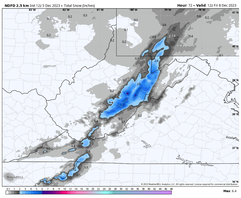
Plowable snowfall is targeting the high country of western Maryland, eastern West Virginia and to some surrounding regions. That’s good news for Mid-Atlantic ski resorts after rather paltry amounts of snow last winter. Some flakes should also spill east of the mountains, perhaps into the D.C. area, although accumulation is unlikely.
Tuesday evening through Wednesday, high terrain from southwest Pennsylvania and southward through eastern West Virginia are expecting about 3 to 6 inches of snow, with some spots potentially seeing more.
The precipitation is initially associated with a “clipper” system divebombing into the Mid-Atlantic from the northwest. These storms originate in Canada and are notoriously moisture-starved and speedy. Even so, they can deliver accumulating snow not only to the mountains, but sometimes to the lower elevations and coastal areas to the east.
Any snow that falls in lower elevations this time around won’t amount to anything. Still, snow lovers could catch a glimpse of some flakes as far east as the D.C. region late Tuesday night into Wednesday.
Storm track
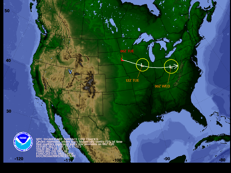
Track of low pressure diving out of the central U.S. toward the Mid-Atlantic. (NWS)
If it was a few weeks later in the season, this storm system would have decent potential to deliver accumulating snow to lower elevations east of the mountains if it had more moisture or was slower-moving. The track, with most of the energy associated with the storm’s low-pressure center passing south of D.C., is generally favorable for snow in and around the nation’s capital.
In this case it won’t matter too much.
That’s because temperatures will be too mild. Tuesday night’s low temperatures east of the mountains are forecast around 33 to 38 degrees which would preclude any accumulation other than a quick dusting. Whereas in the mountains above about 2,000 feet, temperatures should be mainly at or below freezing throughout the event.
Mountain snow
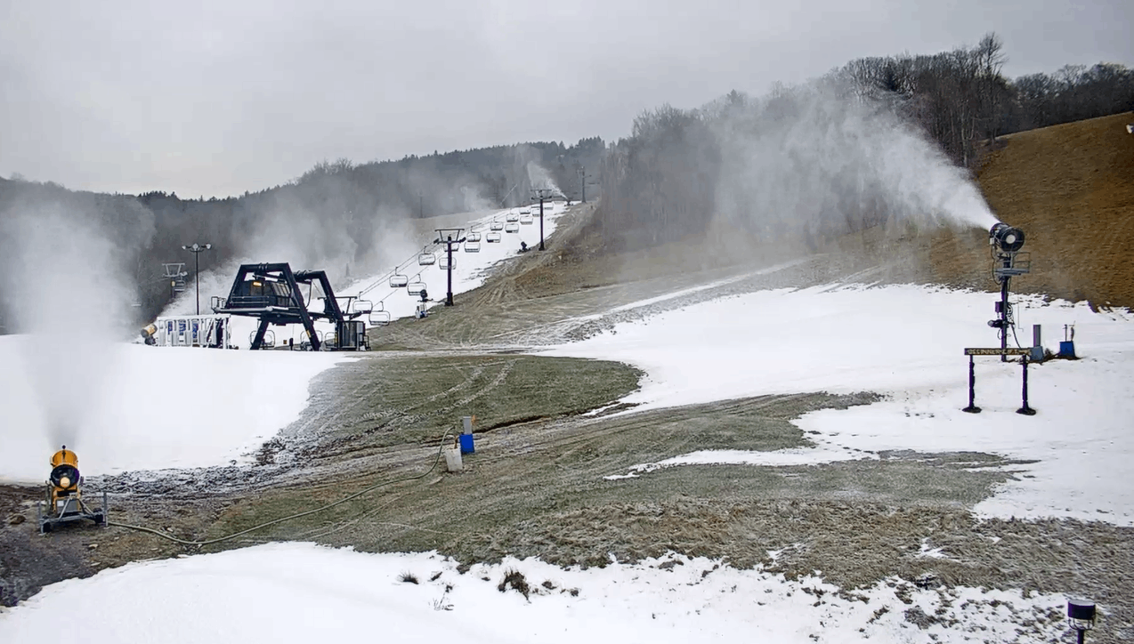
Snow-making was in progress Tuesday morning at Canaan Valley Ski Resort. (canaanresort.com)
Winter weather advisories go into effect Tuesday afternoon and run through Wednesday evening in the Allegheny Front of West Virginia and western Maryland.
The Weather Service expects these regions to begin as mostly snow and then stay snow through the event. With accumulation beginning late Tuesday afternoon and persisting through Wednesday, a widespread 3 to 6 inches is forecast, with some higher totals possible.
A majority of the snowfall in the mountains will come via upslope snow, or orographic lift, on the backside of the clipper as relatively moist air rises from lower to higher elevations, causing clouds and precipitation develop. This is how much of the snow in the impacted area falls in an average winter.
Snow lovers and winter resorts will surely embrace the news of this widespread snowfall. November was also on the snowy side in the highest elevations. Last winter was among the worst on record for snow in the area, with some places at least 5 to 8 feet below average for seasonal tallies.
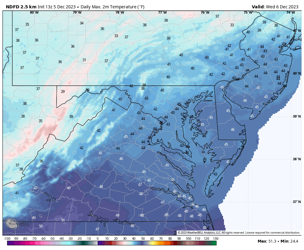
High temperatures forecast for the Mid-Atlantic region on Wednesday. (weatherbell.com)
While mountain snow should readily accumulate given temperatures below freezing through the event, and cold conditions last through Thursday, warmer air is on the horizon as is a risk of rain this weekend. That combination may ultimately limit how long the snow sticks around.
D.C. area “conversational” flakes
In and around Washington, this is a “mood snow” event at most — seeing anything more significant than a period of non-accumulating flakes would be surprising.
If you’re up late Tuesday night or early Wednesday in the D.C. area, you might see rain change over to a period of light snow. The best chance of this is west and northwest of Interstate 95, but the whole area could see conversational snowflakes for a time. If cold air arrives faster than expected, odds of a small dusting go up, but the relatively warm ground temperatures in recent days should limit that risk.
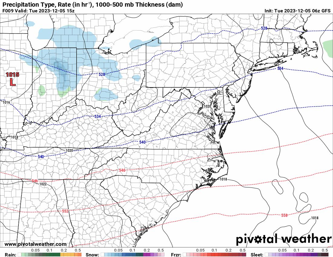
A weak storm system moving toward the Mid-Atlantic from the northwest is expected to redevelop offshore tonight into Wednesday. (Pivotal Weather)
Additional snowflakes may flutter around D.C. at times Wednesday, but more in a showery or flurry type fashion. It’s chilly and breezy through the day with highs only in the low and mid-40s plus wind chills in the 30s.
The closest spots favored to see some light accumulations are the Blue Ridge around Skyline Drive in northwest Virginia and Catoctin Mountain in northern Maryland. The Weather Service is forecasting a coating to an inch or two in the highest elevations of these spots, although they note the potential for a bit more than that.