Met Office warns thunderstorms will hit parts of Britain tonight
Parts of Britain could endure thunder, lightning and heavy rain tonight as unsettled spring weather continues amid concerns over a bank holiday weekend washout.
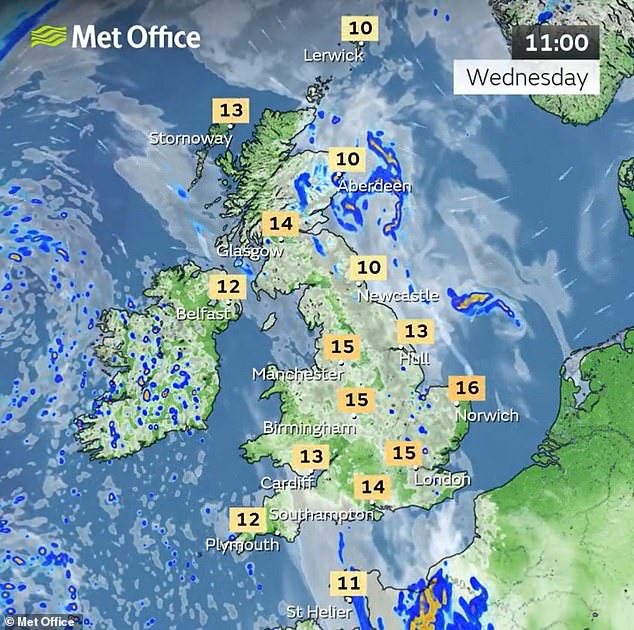
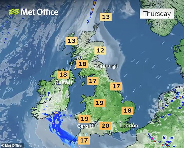
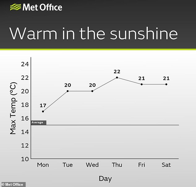
Temperatures are building this week with 20C (68F) highs expected for the South of England again today after yesterday – before 22C (72F) could follow tomorrow.
But the Met Office said the warmer conditions will also bring a risk of ‘active thunderstorms’ across central and southern parts of England and Wales tonight.
Lightning with the risk of hail will move north-westwards across southern England into Wales overnight, particularly during the early hours of tomorrow.
And the Met Office said this bank holiday weekend will be ‘remaining changeable with further spells of rain or showers’ – with rain spreading from the West.
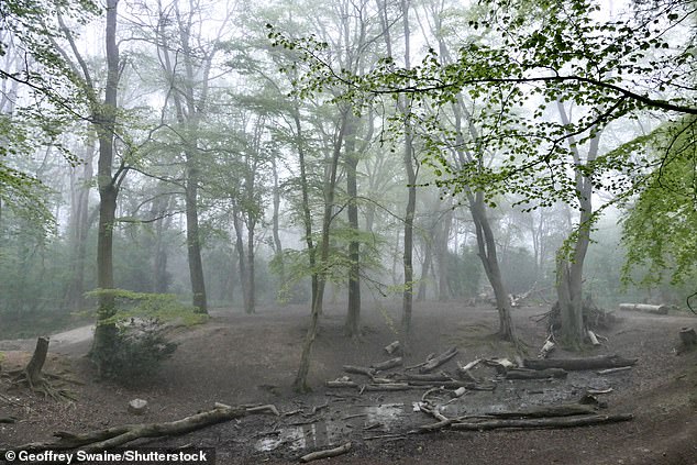
It follows a foggy start in the South East today with showers clipping eastern coasts as they tracked northwards, but sunny spells developing in the South and West.
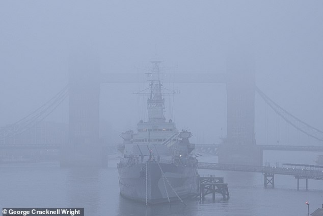
Fog obscures part of Tower Bridge and HMS Belfast on the River Thames in London today
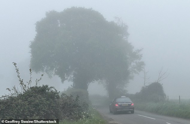
A driver makes their way along a misty country road at Dunsden in Oxfordshire this morning
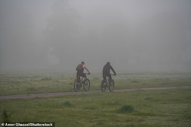
Cyclists riding on Wimbledon Common in South West London today in dense morning fog
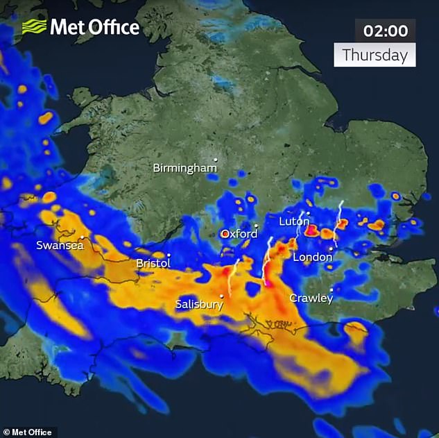
The Met Office said on social media: ‘With higher temperatures this week there is a risk we could see some active thunderstorms in the south on Wednesday night.
READ MORE Is Spring FINALLY on its way? Britain is set to bask in 20C highs by the weekend as nation starts hotting up by mid-week – but forecasters warn of an April shower deluge first with parts of UK under flood watch
‘Lightning with the risk of hail moving north-westwards across southern England into Wales during the early hours on Thursday morning.’
Away from England and Wales, forecasters expect tonight will be dry with mist and low cloud becoming quite widespread in the North and East.
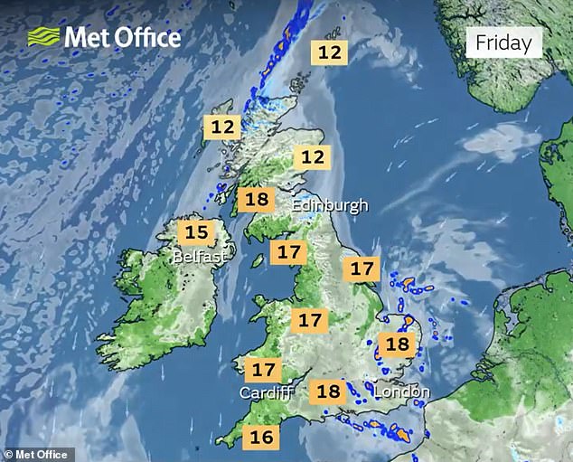
But further rain will hit the South and South West tomorrow, with the risk of thunder again later on – although it will be otherwise largely dry with low cloud gradually clearing.
Temperatures will be warm for many with 22C (72F) possible, although it will be cool along North Sea coasts.
The Met Office outlook for Friday to Sunday is that it will be ‘remaining changeable with further spells of rain or showers, particularly in the south’.
The weather service added: ‘In any drier and brighter interludes it will feel warm away from the east coast.’
In a long range weather forecast from this Sunday until May 14, the Met Office said there would be an ‘uncertain period through the bank holiday weekend with the most likely result a warm but cloudy day Sunday with a few light showers’.
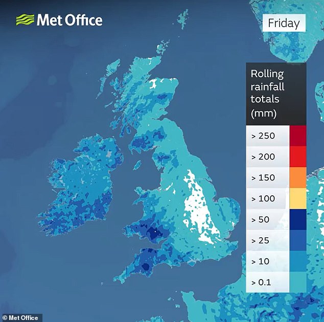
Rainfall totals for the week up to Friday show how western areas will face the wettest weather
Conditions will then be ‘increasingly cloudy with rain spreading from the west, though weakening as it does so, however there remains a broad spread of solutions with the threat of showery spells a common feature’.
READ MORE Washout continues as map shows where heavy rain and brisk cold winds will hammer parts of England
All areas next week are expected to see ‘a mixture of showery periods or spells of rain, though generally drier conditions expected to develop through the following week away from the northeast as high pressure develops to the west’.
The sunniest conditions are expected across the South, while it will be cloudiest in the North and East – with temperatures ‘mostly a little above normal for early May’.
While the threat of imminent flooding has reduced in recent days following heavy downpours over the weekend, the Environment Agency still has 54 alerts in place across England for ‘possible’ flooding.
Most of these are in counties directly to the west and north of London.
Last month, the maximum temperature recorded was 21.8C (71.2F) in Writtle, Essex, on April 13. This was also the warmest day of the year so far.

Motorists driving through the foggy weather this morning in Wimbledon , South West London
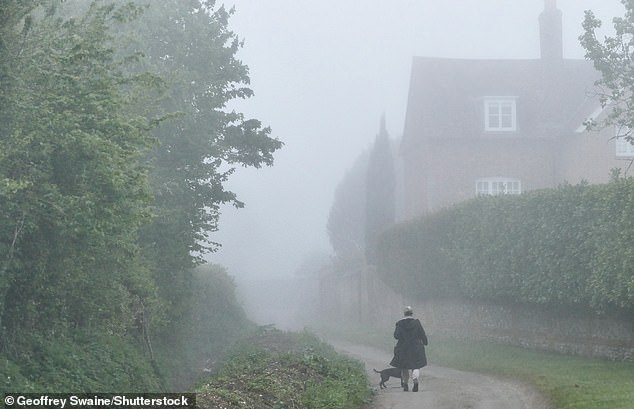
A misty start to the day in the Oxfordshire countryside at Dunsden this morning
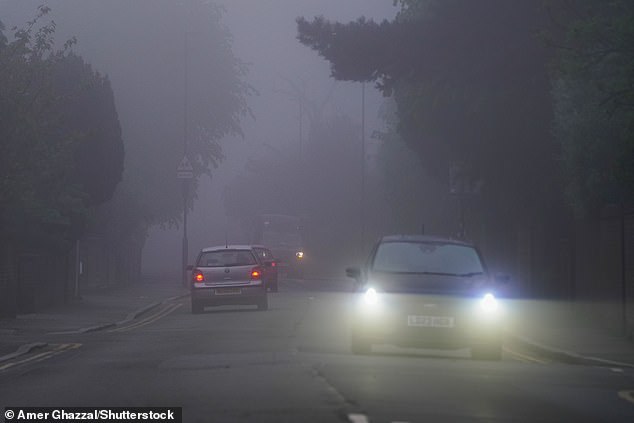
Motorists driving through the foggy weather this morning in Wimbledon , South West London
A misty start to the day in the Oxfordshire countryside at Dunsden this morning
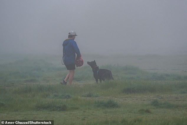
People walking on Wimbledon Common in South West London in the dense morning fog today
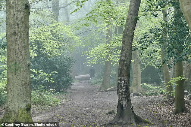
A misty start to the day in the Oxfordshire countryside at Dunsden this morning
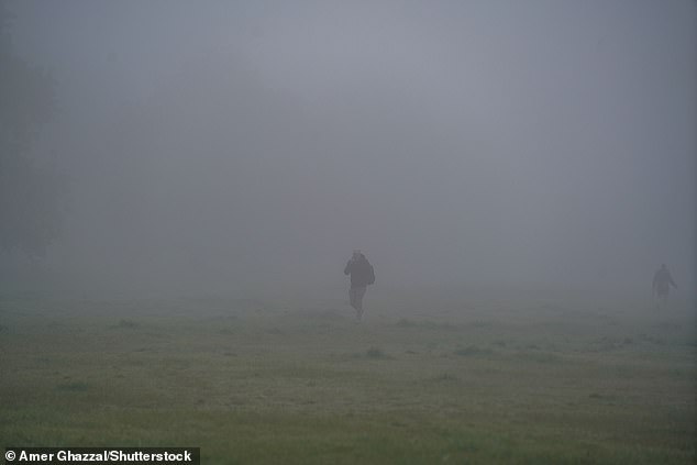
People walking on Wimbledon Common in South West London in the dense morning fog today
The lowest recorded in April was -6.3C (20.7F) in Shap, Cumbria, on April 26.
Grey skies and wet weather means April may have felt unusually cold despite temperatures being higher than average for the time of year, the Met Office said.
The highest UK temperature yesterday was 20.2C (68.4F) in Hull, East Yorkshire.
Bookmaker Ladbrokes said today that it was offering 4/1 on this month going down as the wettest May on record.
A spokesman for the firm said: ‘Things have taken yet another turn for the worse on the weather front and we’re not yet ruling out a record-breaking wet May as a result.’
Read more