Icing potential increases as freezing rain enters central Ohio
Columbus and Central Ohio Weather
COLUMBUS, Ohio (WMCH) – Another round of winter weather alerts will go into effect across all of central Ohio later this evening. The primary threat will be freezing rain that will create ice accumulation on roads and other surfaces by the morning commute on Tuesday.
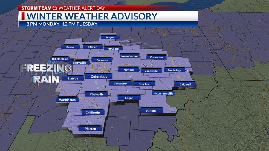
Light freezing drizzle will start around midnight in the northwestern part of the viewing area. Precipitation rates will increase becoming freezing rain by 5 a.m. and become more widespread across central Ohio.
LIVE VIPIR RADAR
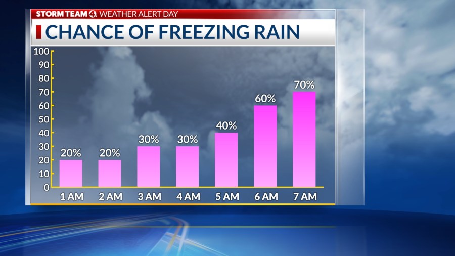
The heaviest freezing rain rates will fall between 7-9 a.m. As the air temperature increases through the day the freezing rain will transition into a wintry mix and then eventually regular rain.
Most of the Columbus metro area can expect at the very least a glaze covering the area. Some ice totals, especially northwest of I-71, may reach 0.10 inches to 0.25 inches. Expect slick driving conditions to last into the early afternoon hours.
Those totals won’t be enough to cause widespread power outages, according to AEP, which said ice starts to become an outage issue when it hits about 1/4 of an inch of accumulation.
“When you start talking ice a degree or two here and there can really change what we see impact wise and while right now we’re not seeing huge impacts for central Ohio as far as our system is concerned from the weather, we are preparing having our crews ready should any outages occur,” AEP spokesman Jay Garrett said.
He said that while the weather may not be a direct cause of outages, the company has to look out for things like cars losing control and hitting power poles or their crews.
To check road conditions in central Ohio to prepare you before heading out the door Tuesday, click here.
Copyright 2022 Nexstar Media, Inc. All rights reserved. This material may not be published, broadcast, rewritten, or redistributed.
For the latest news, weather, sports, and streaming video, head to NBC4 WCMH-TV.